What We Photograph
Commercial and industrial property
Office, retail, warehouse and industrial buildings with their parking, access and surroundings in frame, for listings, lender packages, annual reports and websites. For a sale or lease, aerial imagery answers the questions a street-level photo cannot: how big the lot is, where the loading docks are, what is next door, how traffic gets in and out.
Construction progress
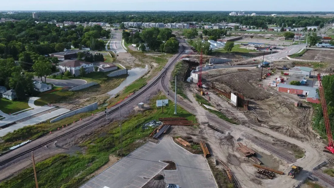
The same angles, from the same positions, on a schedule. Monthly or milestone progress photography gives the owner, lender and contractor a shared record of what was built when, which settles pay-application questions before they start. If the project also needs quantities, the same visit can produce a mapped surface and volumes; the photographs come along with it.
Land, farms and lakeshore
Agricultural parcels, development land, hunting ground and lake lots photographed with their drainage, tree lines, shorelines and access roads visible. For land auctions and listings in the Dakotas and Minnesota, the aerial set is usually the first thing a serious buyer opens.
Plants, facilities and infrastructure
Grain elevators, ethanol and processing plants, substations, yards, quarries and pits, documented for insurance, planning, safety reviews and marketing. Flying a site we also map means the photography is often a small addition to work already scheduled.
Marketing and documentation imagery
Hero shots for a company website or a bid package, before-and-after pairs for a completed project, and short video passes that show a property or site in motion. We deliver edited files sized for print and web and keep the originals.
How We Fly It
- Airspace first. Fargo–Moorhead, Grand Forks, Duluth and a number of other Upper Midwest cities sit in controlled airspace. We obtain LAANC authorization in advance, and file for FAA authorization where LAANC does not apply, so the shoot happens on the day it is scheduled.
- Planned positions. For progress work, camera positions, altitudes and headings are recorded on the first visit and repeated on every visit after it, so the images line up month to month.
- Light and weather. We shoot for the light the subject needs, early or late for property and marketing work, midday when the point is documentation, and we reschedule for wind, precipitation or smoke rather than deliver a flat set.
- Georeferenced when it matters. Every image carries its position and heading. When a project needs imagery that lines up with a plan, we fly it as a mapped product and deliver an orthomosaic alongside the photographs.
- Insured and documented. Every flight is under FAA Part 107 with $5M liability coverage, the same as every mapping flight we make.
Deliverables
- Edited still images at full resolution for print and sized versions for web and listing platforms
- Video clips where ordered: smooth orbits, reveals and fly-overs, delivered as finished clips or raw footage for your editor
- Progress sets organized by date and camera position, so any two visits can be compared side by side
- Orthomosaic on request, a single georeferenced top-down image of the whole site that opens in GIS or CAD
- Original files retained, so additional crops or edits can be produced later without reflying
Where Drone Photography Earns Its Cost
It earns its cost when a picture has to carry a decision: a lender deciding on a loan package, a buyer deciding whether to drive out to a parcel, an owner deciding whether a contractor is where the schedule says he is. It also earns it when the alternative is a lift, a plane or a person on a roof. A drone flight is cheaper than any of those and safer than the last one.
When We Will Tell You Not to Buy It
If what you need is a mapped surface, measured quantities or a certified deliverable, photography alone will not get you there and we will say so; the LiDAR and volumetrics pages describe what does. And if the site sits in airspace that will not clear on your timeline, we will tell you before you plan around the shoot.