Drone Survey Services in Sioux Falls, South Dakota
Sioux Falls is 240 miles straight down I-29 from West Fargo, a half-day drive we make often enough to quote it with a modest travel line rather than a deployment. It is also one of the fastest-growing cities in the Midwest, with the construction market to match: subdivisions and industrial parks pushing out in every direction, the Big Sioux River and its levee system threading through the middle, the quartzite quarries that have supplied the city since it was founded, and the ethanol, processing and logistics plants along I-29 and I-90. LiDAR, airborne GPR, bathymetry, stockpiles and thermal, flown by a Northern Plains crew.
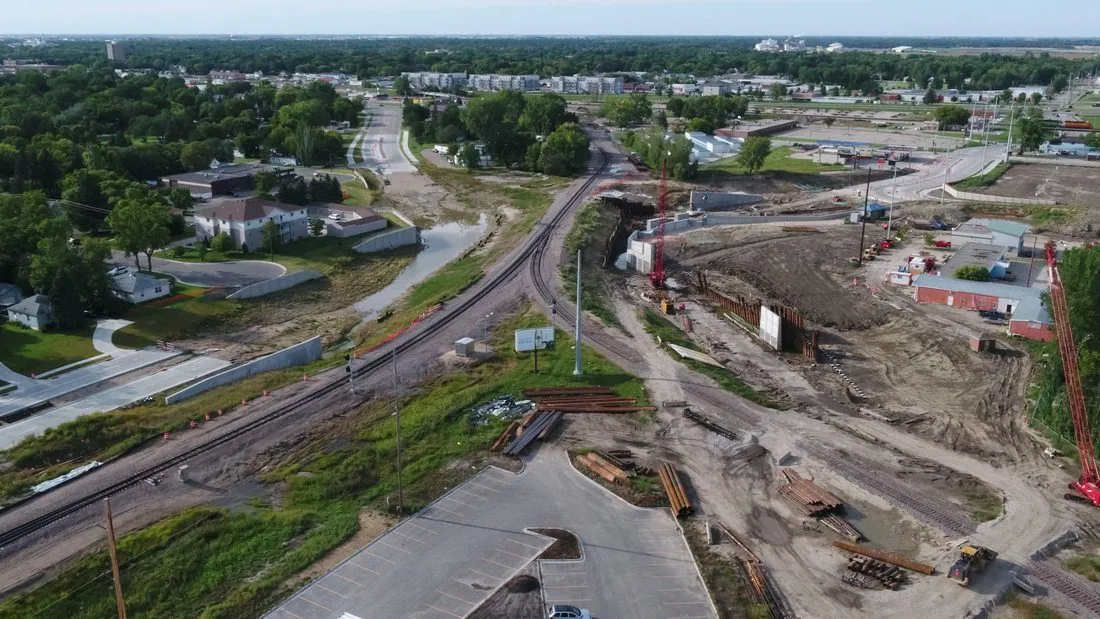
Work We Do Around Sioux Falls
- LiDAR mapping — pre-construction terrain and drainage models for subdivisions, industrial parks and campus sites, levee and floodplain surfaces along the Big Sioux and Skunk Creek, and corridor LiDAR for the transmission lines feeding the metro.
- Drone-based GPR — quartzite bedrock depth for foundation and utility design, which in Sioux Falls can go from a few feet to tens of feet across one parcel, plus buried utility screening on redevelopment and campus sites.
- Stockpile volumetrics — quartzite, sand, gravel and recycled aggregate volumes at the producers and contractor yards around the city, with the auditable per-pile report a month-end close needs.
- Bathymetric surveys — flooded quarry and gravel pit depth mapping, stormwater basin and detention pond surveys, and river backwater and diversion channel sediment work, with no boat on the water.
- Thermal inspection — roof moisture and envelope surveys on warehouses, hospitals and commercial buildings, and electrical, substation and solar inspection.
Why a Northern Plains Crew in Sioux Falls
The thing to know about Sioux Falls ground is the rock. Sioux Quartzite sits at the surface along the river and drops away under glacial clay as you move out from it, and a developer who guesses wrong about where it is pays for it in blasting, utility reroutes or a redesigned footing. Airborne GPR profiles the bedrock surface across a whole site in a morning, with no potholing crew, and tells the geotechnical engineer where to bore. LiDAR on the same visit gives the terrain and drainage model the site plan needs.
Joe Foss Field has Class D airspace that covers much of the north side of the city, so many urban sites need LAANC authorization, which we hold before we drive down. Flood work follows the Big Sioux River Flood Control Project and the city’s drainage rules, and we deliver levee and channel surfaces in the project datum so they tie to the design. Data is processed in West Fargo and back within 72 hours. Northern Drone is a drone data-collection firm, not a licensed land surveying firm; when a project requires certified deliverables, we partner with licensed professionals who review and stamp the final product.
Service Area Around Sioux Falls
From Sioux Falls we cover Brandon, Harrisburg, Tea, Hartford, Dell Rapids, Madison and Brookings to the north, Canton, Vermillion and Yankton to the south, Mitchell on I-90 to the west, and the Minnesota and Iowa side of the metro, including Luverne, Rock Rapids and Sioux Center. Statewide, see our South Dakota service page.
Sioux Falls Drone Survey FAQ
A modest line item. Sioux Falls is about 240 miles from our base on I-29, which we quote as one transparent travel line rather than a buried day rate. For multi-site programs around the metro we sequence the stops into one trip so it is shared across them.
Yes. FSD has Class D controlled airspace covering a large part of the north side of the city. We obtain LAANC authorization for the altitude block each site needs during mission planning, so the flight is approved before we arrive. Sites outside the Class D boundary, including most of the south and east sides of the metro, are uncontrolled.
That is one of the most useful things we do in Sioux Falls. Airborne GPR maps the depth to bedrock across the site as a surface, so the engineer sees where it is shallow and where it is not before placing a single boring. It is a screening tool that targets the geotechnical program; it does not replace it, and the report says so.
Northern Drone is a drone data-collection firm, not a licensed land surveying firm. When a Sioux Falls project requires deliverables certified by a Professional Land Surveyor or Engineer, we perform the field acquisition in partnership with licensed professionals who review and stamp the final product.
Have a Site in The Sioux Falls metro?
Tell us where it is and what you need measured. Scoped quote within one business day, with travel shown as one line, not buried in a day rate.
Get a Sioux Falls Quote →