Drone Survey Services in Bemidji, Minnesota
Bemidji is about 140 miles northeast of our West Fargo base, two and a half hours on US-2, which makes it a short deployment we schedule readily. It is the first city on the Mississippi, surrounded by lakes, pine and hardwood forest, peat bogs and the reservation lands of Red Lake and Leech Lake, with pipeline corridors crossing the whole region. That is bathymetry, LiDAR and GPR country in equal measure: water to be mapped without a boat, ground to be found under the canopy, and organic soils to be profiled before anything is built on them.
Work We Do Around Bemidji
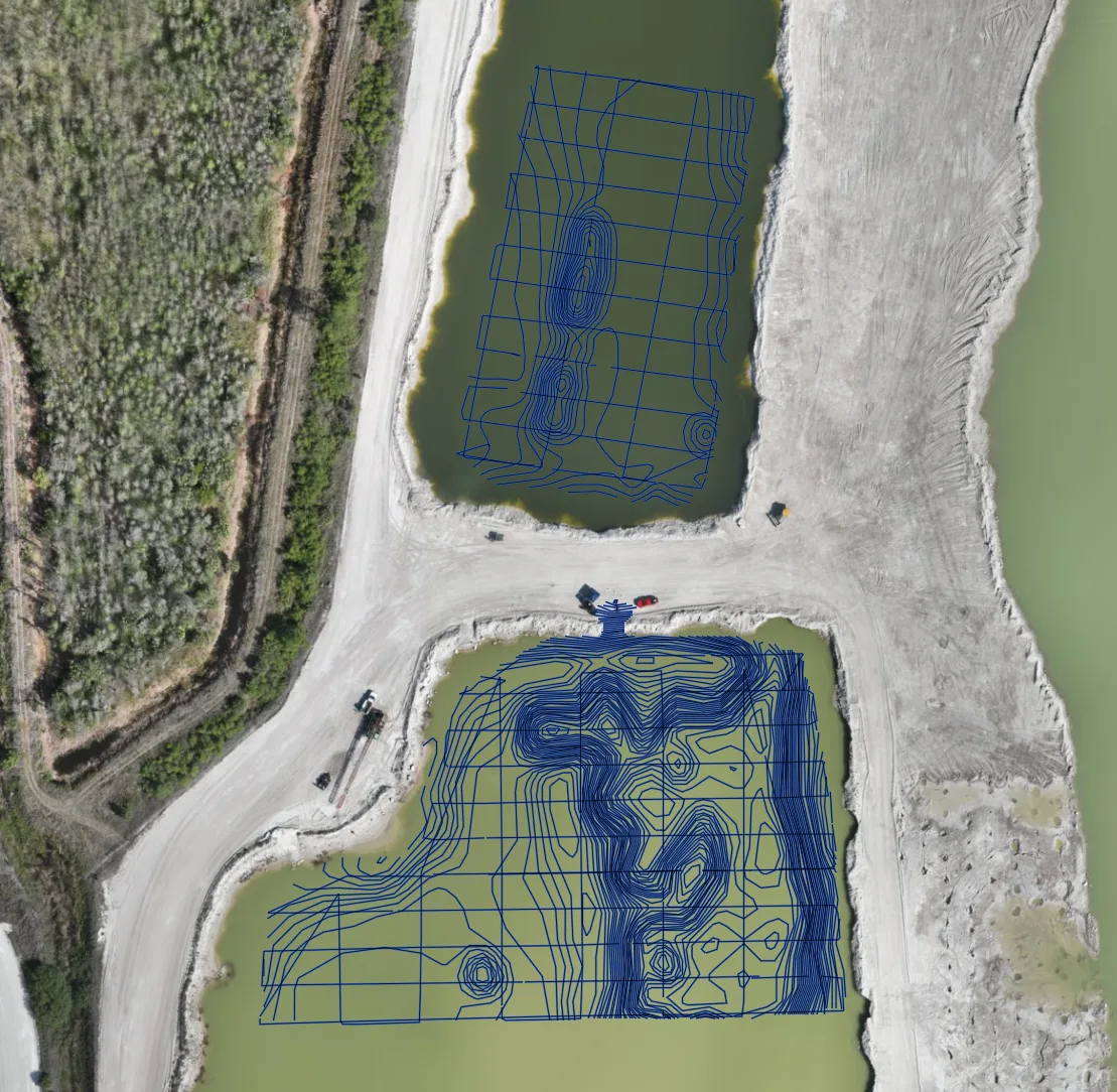
- Lake and pond bathymetry — depth, sediment and aquatic-vegetation mapping of lakes, ponds, bays and river reaches for lake associations, cities, counties and tribal natural-resource programs, with no boat crew. See also dredging and sedimentation surveys.
- LiDAR mapping — bare-earth terrain under pine, aspen and hardwood canopy for drainage, road and site design, forestry canopy models, and corridor LiDAR for transmission lines and pipelines across Beltrami, Hubbard and Clearwater Counties.
- Peat and wetland GPR — peat depth and wetland boundary profiling with airborne GPR before road, utility or development work on organic soils, and buried utility screening on campus and city sites. See drone GPR.
- Pipeline depth of cover — cover-depth profiles along the pipeline corridors that cross north-central Minnesota, measured from the air with no potholing crew.
- Stockpile volumetrics — aggregate, sand, salt and wood-product volumes for producers, mills and county public works yards.
- Thermal inspection — roof moisture and envelope surveys on campus, resort and commercial buildings, and electrical inspection.
Why Bemidji Is Bathymetry and LiDAR Country
Around Bemidji, the ground is either under water, under trees or under peat, and each of those defeats a different ground-survey method. A boat crew sounds a lake in days and misses the shallows; a drone echo sounder maps the whole basin, bays and shallows included, in hours. Photogrammetry sees treetops; LiDAR sees the ground between them. A soil probe tests one point in a bog; airborne GPR profiles the whole crossing. One deployment carries all three sensors, and the data lands on one coordinate system.
Bemidji Regional Airport sits in uncontrolled airspace outside its immediate approach paths, which simplifies planning for most sites. Work on Red Lake and Leech Lake reservation lands follows each nation’s permitting and we coordinate it before scheduling. Data is processed in West Fargo and back within 72 hours. Northern Drone is a drone data-collection firm, not a licensed land surveying firm; when a project requires certified deliverables, we partner with licensed professionals who review and stamp the final product.
Service Area Around Bemidji
From Bemidji we cover Cass Lake, Walker, Park Rapids, Bagley, Blackduck, Red Lake, Thief River Falls, Grand Rapids and the lakes and forest of Beltrami, Hubbard, Cass, Clearwater and Itasca Counties. Statewide, see our Minnesota service page.
Bemidji Drone Survey FAQ
A modest line item; Bemidji is two and a half hours from our base and we schedule it readily, often pairing lake, forest and corridor sites on the same trip so the travel is shared.
Most lakes in the region, yes. The drone echo sounder maps depth across the full basin including the shallows a boat avoids, and delivers contours, cross-sections, sediment thickness and volume. Very large lakes are flown in sections across more than one day; we scope that honestly up front.
Yes. Airborne GPR profiles the organic layer across the whole crossing or parcel and shows where the peat is deepest, which is what a road or utility design needs before deciding on excavation, surcharge or a different route. It is a screening tool that tells your geotechnical engineer where to probe, and we say so in the report.
Northern Drone is a drone data-collection firm, not a licensed land surveying firm. When a Bemidji project requires deliverables certified by a Professional Land Surveyor or Engineer, we perform the field acquisition in partnership with licensed professionals who review and stamp the final product.
Have a Site in Bemidji and the north-central lakes?
Tell us where it is and what you need measured. Scoped quote within one business day, with travel shown as one line, not buried in a day rate.
Get a Bemidji Quote →