Your Site.
From Above.
With Precision.
Northern Drone delivers specialist survey and inspection data for agriculture, telecom, solar, LiDAR, GPR, and bathymetric applications — on time, certified, and ready to integrate.
Dangerous Jobs. Slow Timelines. Bad Data.
Traditional survey and inspection methods haven't changed in decades. You're sending crew up towers, wading through wetlands, and waiting weeks for processed data that's already outdated.
Northern Drone replaces all of that. Specialist platforms. Certified pilots. Actionable deliverables — in 24 hours.
- ⚡Tower climbs cost thousands and carry real injury risk — we eliminate them entirely.
- 🌾Crop health issues stay invisible until it's too late — we see them from 120m up.
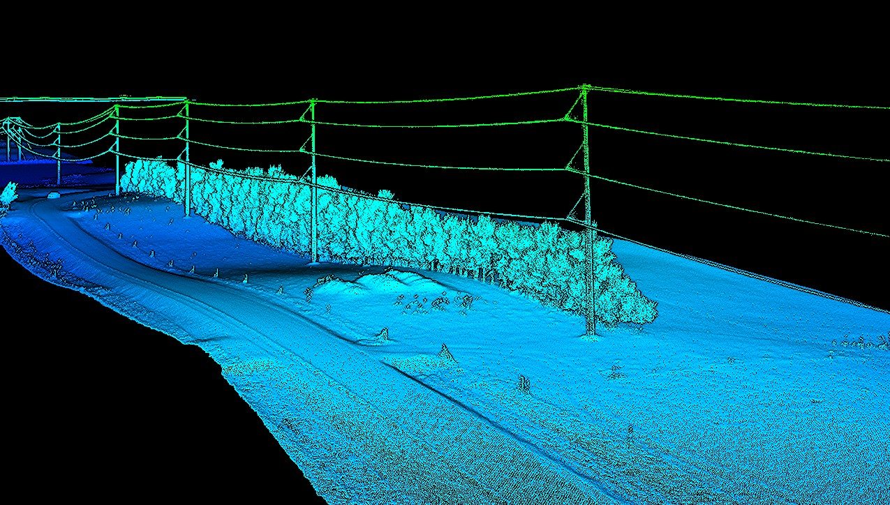
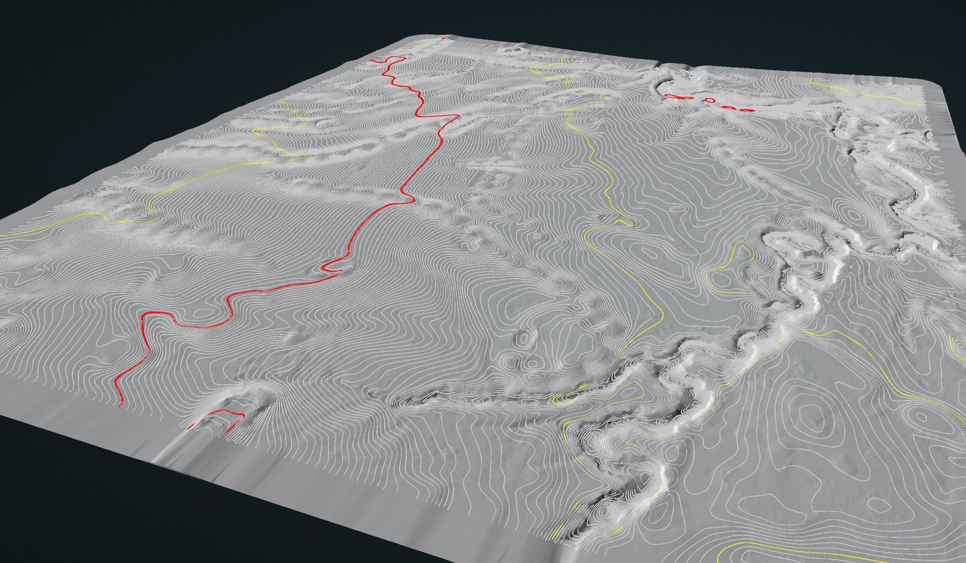
- 🗺️Ground surveys miss what's under canopy — our LiDAR sees through it.
Every Mission.
The Right Sensor.
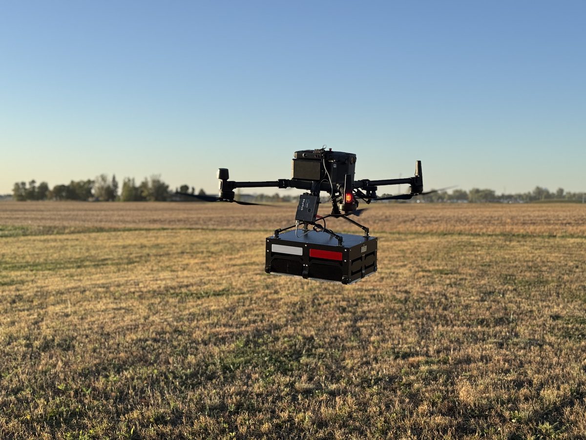
We don't fly one drone and call it a service. Each line uses purpose-built equipment and pilots trained specifically for that application.
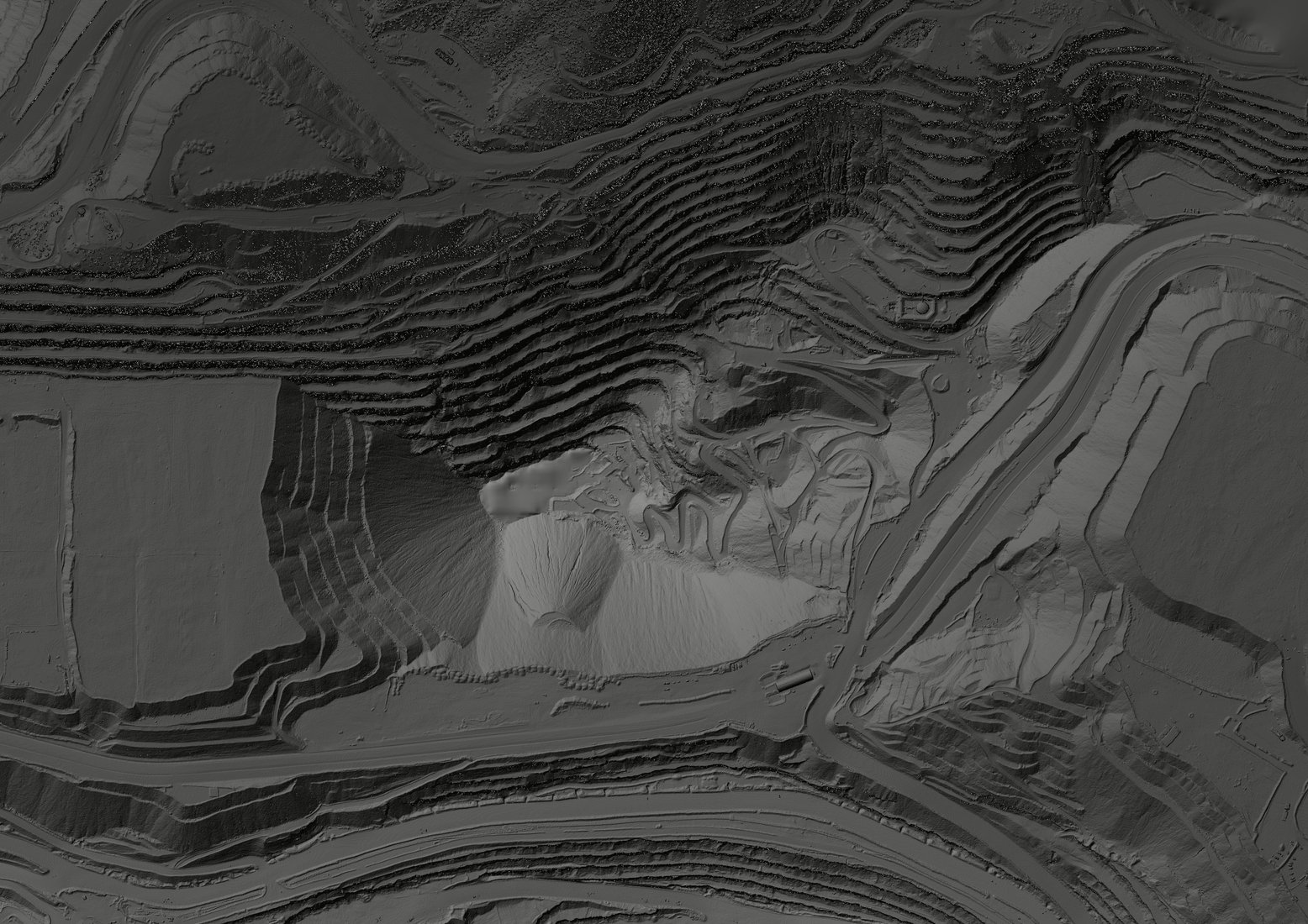
Dense 3D point clouds for terrain modelling, corridor surveys, and bare-earth DTMs through dense vegetation.
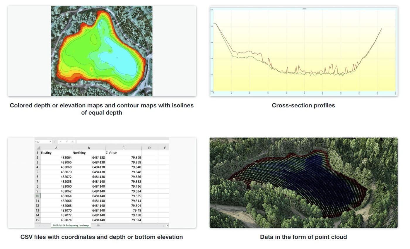
Sonar-equipped USV platforms for flooded quarry pit mapping, volume calculations, and dewatering planning. No dive crew, no boat, no downtime.
Airborne ground-penetrating radar for sub-surface mapping, utility detection, and geotechnical surveys in hazardous terrain.
Aerial photogrammetric stockpile volume measurement with 1–2% accuracy. No crew on the pile, no halting operations.
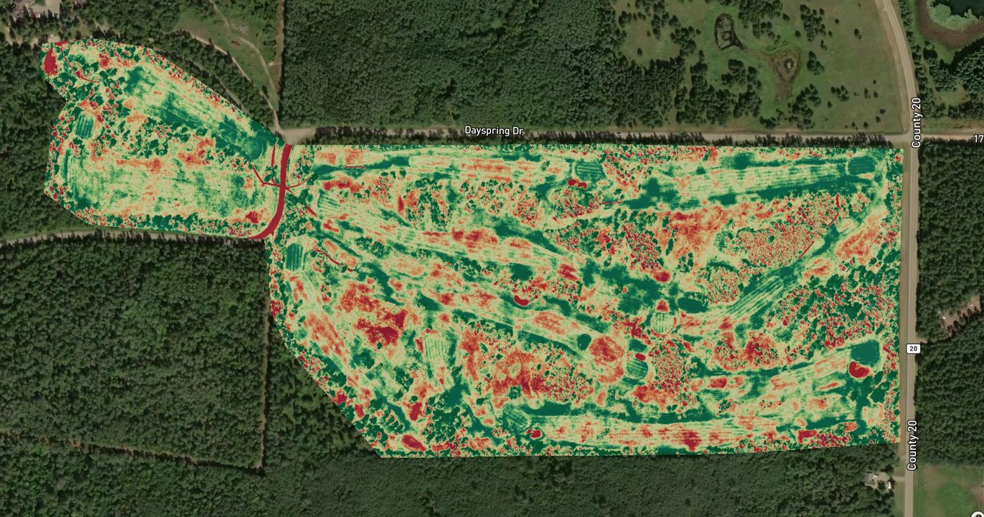
Multispectral and thermal imaging for crop health, NDVI mapping, and precision agronomy at any scale.
Radiometric thermal surveys to identify panel faults, hotspots, and delamination across utility-scale arrays.
From First Contact to Final Deliverable — Four Steps.
Tell us your project, location, and timeline. We'll come back with a scoped proposal or clarifying questions within one business day.
We handle all airspace authorizations, flight planning, weather windows, and logistics. You don't lift a finger.
FAA Part 107 certified pilots on-site with the right platform for your mission. Safe, efficient, and fully insured from takeoff to landing.
Processed, QA-checked deliverables in your required formats within 72 hrs standard — or 36 hrs with rush processing — ready for GIS, CAD, or farm management platforms.
What Our Clients Say
"Cody is very professional with an eye for detail. I love his drone video services and his 3D virtual tour. Especially..."
"Northern Drone has the best pricing in the area for the services they provide. They were also able to get my photos and videos to me within only 2 days with no extra charge! Definitely recommend!"
"Cody was attentive, knowledgeable, helpful, and all around excellent! The work he did for us really helped to flesh out..."
Every Project Is Different.
Here's How We Price Them.
We don't publish rate cards — because a 2-mile powerline corridor and a 200-mile one aren't the same job. Every quote is scoped to your specific site, sensor requirements, deliverable format, and timeline. Here's exactly what goes into it.
The primary driver of cost. A 10-acre construction site and a 100-mile transmission corridor require very different flight plans, ground control setups, and processing time.
Different services require different equipment. LiDAR corridor surveys, drone GPR, and bathymetric mapping each use specialized platforms with different operational requirements.
What you need at the end affects how long processing takes. A classified LiDAR point cloud with encroachment reports takes more time than a raw orthomosaic — and a 36-hour rush costs more than standard 72-hour turnaround.
Fill out the quote form or call us. Site size, service needed, and your timeline — that's all we need to start.
We review your requirements and put together a detailed proposal within one business day. No vague estimates.
Fixed price, clear deliverables, confirmed timeline. No surprises. You know exactly what you're getting before we fly.
Data in your hands within 72 hours standard. Rush processing available. Formats ready for your GIS, CAD, or reporting workflow.
Most projects are quoted within one business day. There's no obligation and no sales pressure — just an honest number for your specific job.
Nationwide Coverage.
We Come to You.
Northern Drone operates across the United States with full mobile deployment capability. Headquartered in West Fargo, ND — we regularly serve clients throughout the Midwest, Great Plains, and beyond. Your site, wherever it is.
Come to You
Ready to
fly?
Tell us about your project. We scope, plan, and fly — you get actionable data in 24 hours.