Drone Survey for Municipal & Government Projects
Buried infrastructure of uncertain age, channel geometry that has to be documented for permitting, and terrain data that will end up in the public record.
See What's
Under the Surface.
Ground-penetrating radar from a drone platform brings sub-surface investigation to terrain that is too hazardous, too wet, or too remote for traditional cart-based GPR crews. It is one of the most technically demanding services we offer — and one of the most valuable for the right project.
Drone GPR flies 1–3 meters above the ground, transmitting radar pulses downward and capturing reflections from sub-surface boundaries — soil layers, voids, buried infrastructure, and geological features. Northern Drone operates FCC Part 15 / §15.509-compliant GPR systems on qualifying projects including commercial mining, construction, and scientific research applications.
GPR depth and resolution are determined by antenna frequency. Higher frequency (500–1000 MHz) achieves 1–5 m penetration with ~5–15 cm resolution — suitable for utility detection, shallow geology, and void identification. Lower frequency (100–250 MHz) reaches 5–20 m with coarser resolution — suited for deeper geological surveys. All figures assume typical soil dielectric properties and degrade significantly in high-clay, high-moisture, or saline ground.
Drone GPR's advantage is access — not absolute resolution. It excels in hazardous or inaccessible terrain: active quarries, contaminated sites, steep embankments, and areas with standing water or unstable ground. Documented applications include utility detection, void/sinkhole assessment, sub-surface geological mapping, forensic investigation, and UXO/buried-object detection in hazardous environments.
Ground-coupled GPR delivers higher signal-to-noise ratio, deeper effective penetration, and better local-target resolution than airborne GPR — because direct ground contact maximizes energy transfer. Drone GPR trades some resolution for speed and access. For large, inaccessible, or hazardous areas, drone GPR is the right tool; for precise utility locating in accessible terrain, ground-coupled GPR remains superior. We'll tell you which is right for your project.
Drone GPR in the U.S. operates under FAA Part 107 (platform) and FCC 47 CFR §15.509 (GPR emissions). FCC §15.509 restricts GPR use to specific eligible parties including commercial mining, construction, and scientific research. We operate compliant systems on qualifying projects and coordinate with applicable regulatory requirements on every deployment — this is not a gray area we ignore.
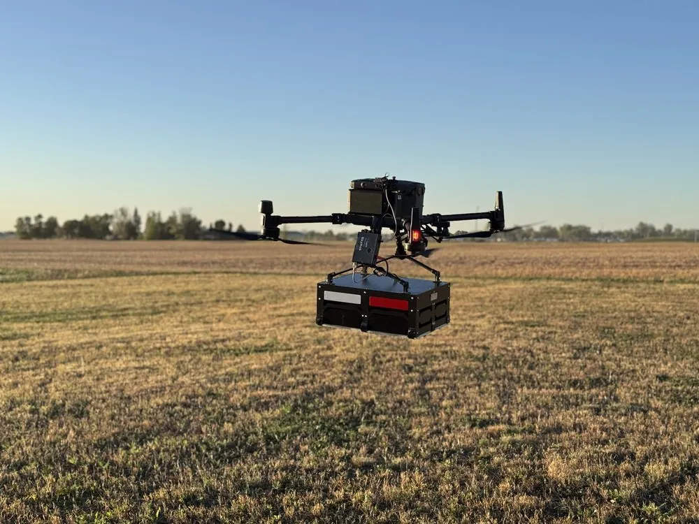
FCC §15.509 was written for ground-coupled GPR. Airborne deployment in the U.S. requires either (a) eligibility under one of the specified use categories (mining, construction, emergency services, scientific research) or (b) an FCC waiver on a case-by-case basis. We operate within these requirements — and we disclose this upfront because we believe you deserve accurate information about the regulatory framework around the services you purchase.
Have a Site That Needs Sub-Surface Data?
Tell us about your project — terrain type, target depth, and access constraints — and we'll tell you honestly whether drone GPR is the right tool or whether a different approach would serve you better.
Questions About Municipal Drone Surveys
Working in Municipal & Government?
Tell us the site, the constraint, and what decision the data has to support. We will scope it honestly — including telling you when a cheaper method would do the job.