Drone Survey for Quarries
A drone survey for a quarry measures three things in one site visit: the volume of every stockpile on the yard, the current shape of the pit and its highwalls, and, where the pit is flooded, the depth and volume of the water-filled area. Northern Drone flies all three from one mobilization, with nobody on the pile, the highwall or the water, and with production running throughout. Data is back within 72 hours in the format your inventory system, engineer or reclamation consultant uses.
Stockpile inventory
Every pile on site is measured in the same flight, including the ones that are awkward to walk. With surveyed ground control and a defined base surface, volumes are reported at 1–2% accuracy, and the report lists the base surface used for each pile so an auditor or a buyer can check the number. Month-end and quarter-end inventory flights are the most common schedule; the same data also settles disputes over delivered tonnage when the density is known. See the stockpile volumetrics service page for how the measurement is done.
Flooded pit bathymetry
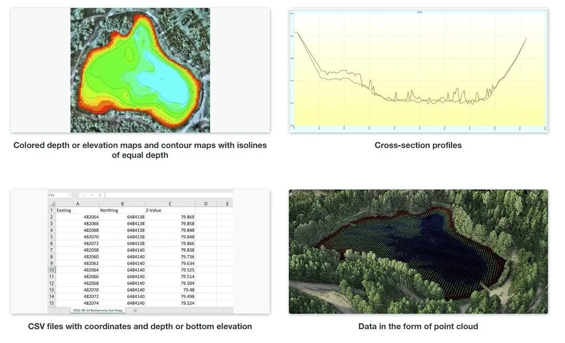
A drone-mounted echo sounder flies the flooded area and returns depth with RTK positioning, so water volume, remaining material under water and sediment build-up are measured without a boat or dive team. The deliverable is a depth contour map, cross-sections and a point cloud that joins to the dry-land survey, which is what dewatering plans and extraction decisions are made from. The Florida dredge pond case study shows this done in a single day.
Pit, highwall and haul road mapping
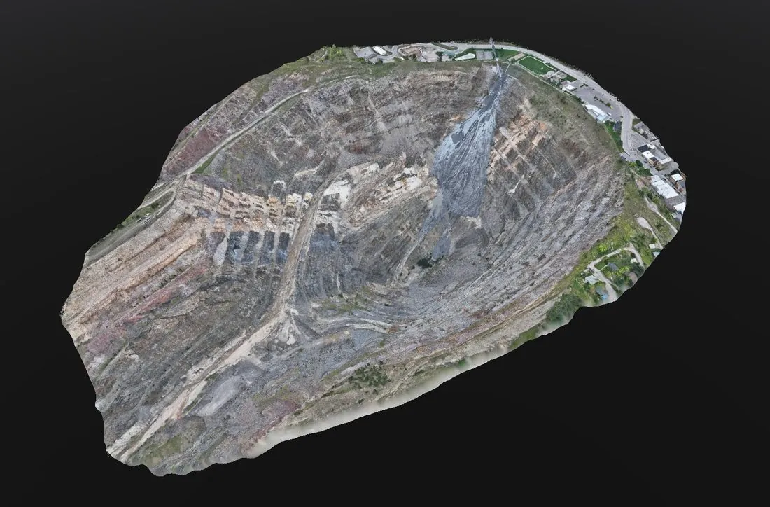
The same flight produces a georeferenced orthomosaic and a surface model of the whole operation: pit floor, benches, highwall crests and toes, haul roads and berms. That surface is the basis for extraction planning, end-of-period cut volumes, highwall stability reviews by your engineer and the site map that reclamation bonding and permit renewals are built on. Re-flying on a schedule turns it into a change record.
Supporting MSHA and reclamation reporting
MSHA requires current mine maps, hazard assessment and prompt reporting of unplanned flooding; state reclamation programs require bonded acreage and disturbed-area reporting. A drone survey produces the geometry those documents are built from and documents site conditions on a known date. Northern Drone provides the data; what each operation must file is decided by your safety officer and counsel.
What to expect on survey day
- Ground control set and checked before the flight; no production stoppage, no exclusion of equipment from the pit
- One mobilization for stockpiles, pit surface and bathymetry; most quarries are flown in a single day
- Volume report with a per-pile table, orthomosaic, surface model, contours and point cloud, delivered within 72 hours
- Pricing is per site visit and depends on acreage, pile count and whether bathymetry is included; the drone survey cost guide has the ranges
Northern Drone flies quarries and aggregate operations from West Fargo, North Dakota across Minnesota, the Dakotas and Iowa, and nationwide for multi-site operators.