A transmission line operator needed to identify trees and vegetation growing within critical clearance zones along a multi-mile corridor. Our LiDAR platform flew the full route and produced a classified point cloud separating ground, low vegetation, and tall vegetation — pinpointing every encroachment risk before a single field crew was dispatched.
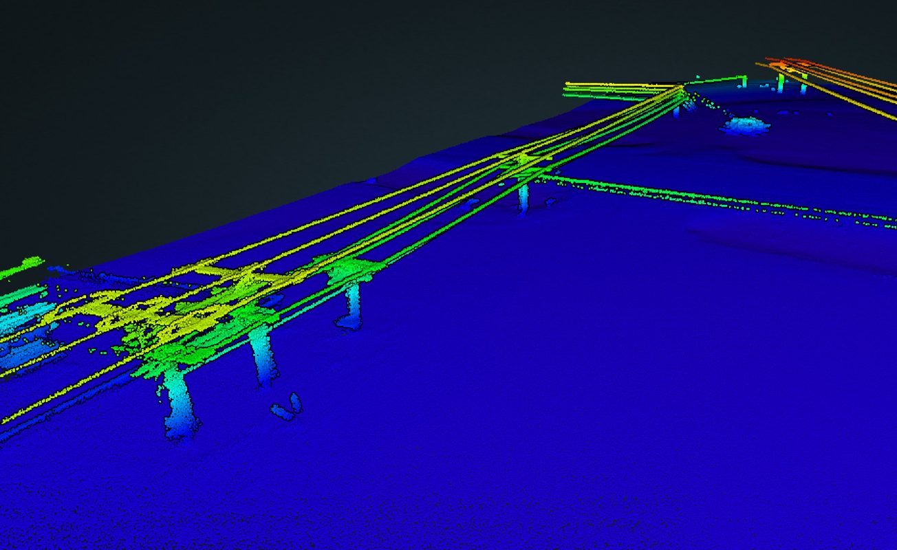
Elevation-classified point cloud of a railroad bridge crossing showing exact conductor sag geometry and structure-to-ground clearances across the full span. The rainbow-colored elevation data gave the client a precise, measurable 3D model of the crossing — replacing estimates with engineering-grade measurements.
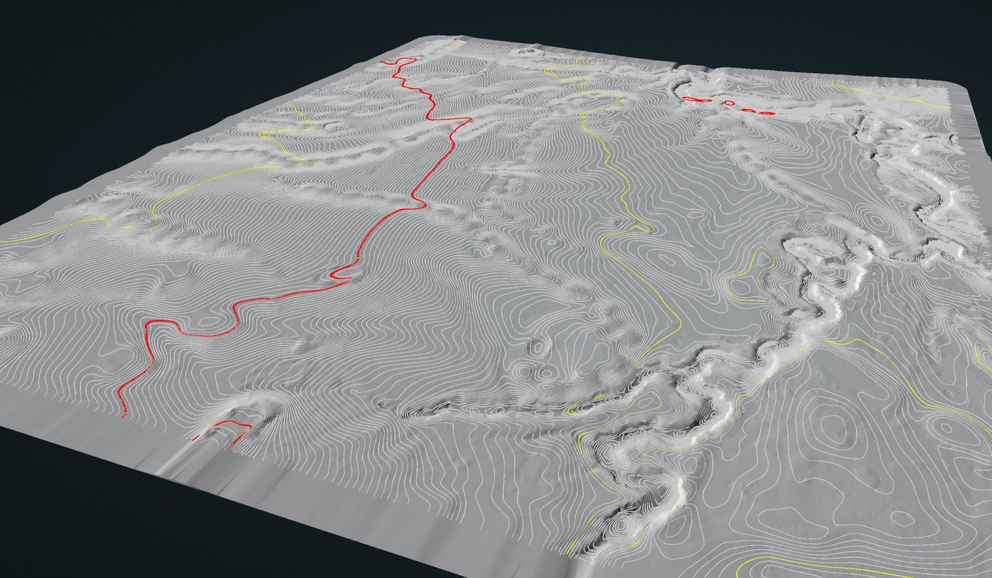
Full DTM with white contour lines and feature mapping (drainage channels in red, boundaries in yellow) captured before ground was broken on a development site. The engineering team used the data for accurate cut/fill volume calculations, drainage planning, and grade design — avoiding costly surprises during construction.
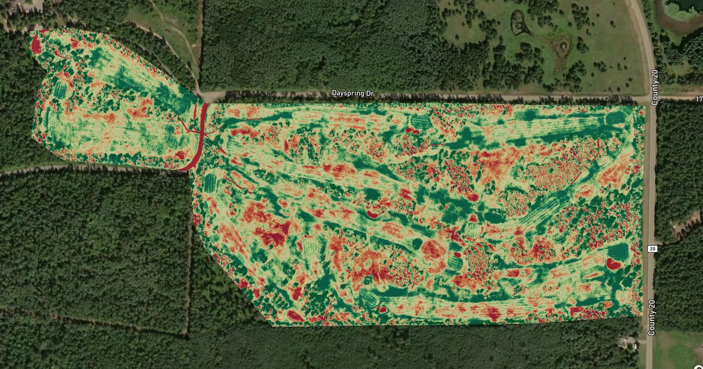
NDVI multispectral survey of a Midwest 18-hole golf course revealing turf stress patterns invisible to the naked eye. Red zones indicate low vegetation health (stress, disease, compaction), green shows healthy stands. The superintendent used the map to target aeration, overseed, fertilizer, and irrigation decisions — cutting inputs while improving course condition.
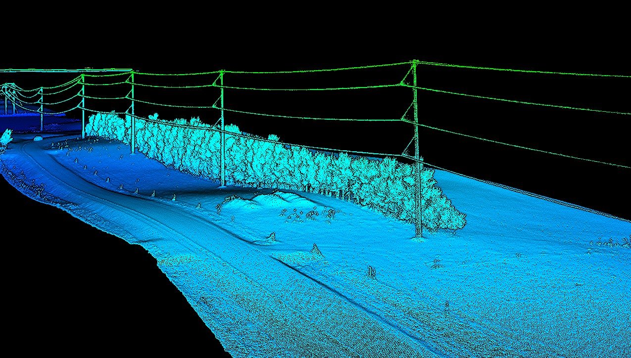
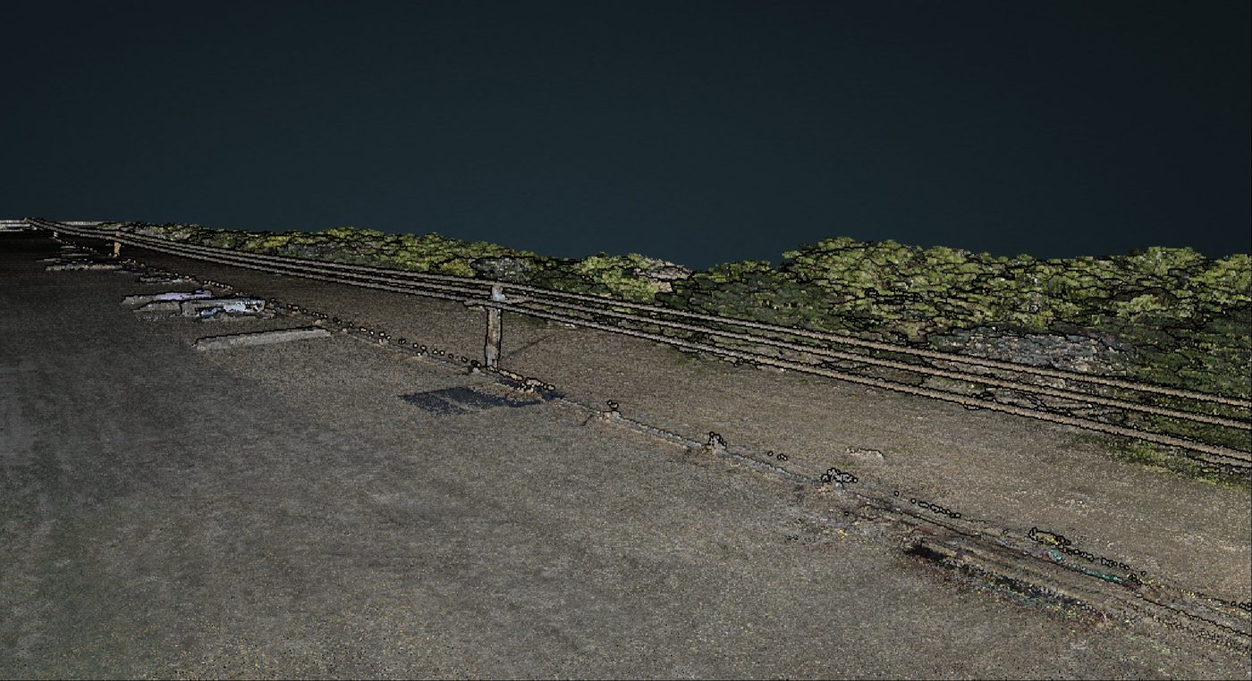
Precision LiDAR corridor survey with green-classified conductors separated from ground, structure, and vegetation returns. Each wire is individually resolved with exact catenary geometry — giving the utility precise sag measurements, clearance calculations, and structure-to-conductor distances without a single climber deployed.
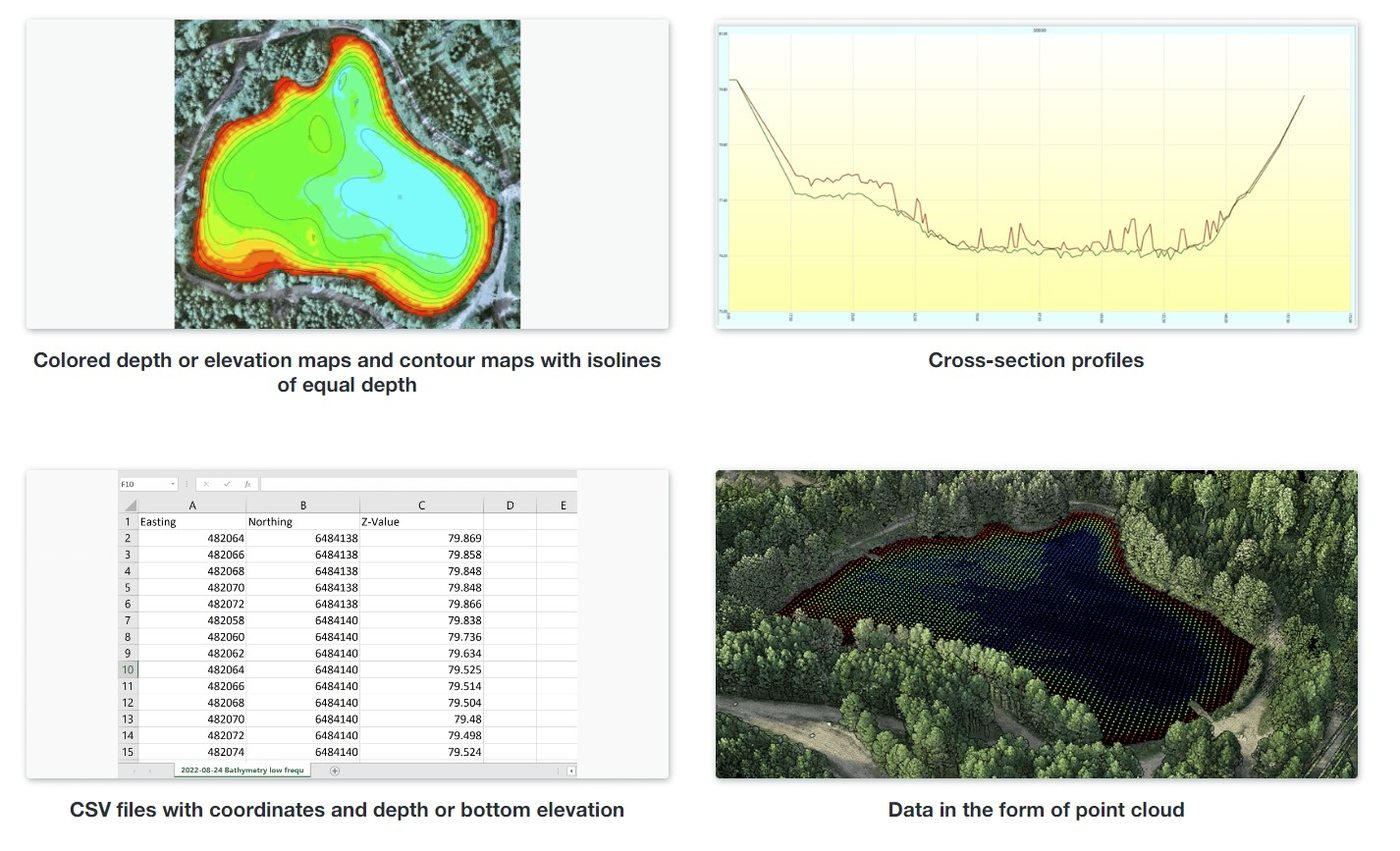
Drone-based sonar bathymetric survey of a flooded quarry pit delivering color-coded depth contours, cross-section profiles, a georeferenced point cloud, and a full CSV of Easting/Northing/Z-Value coordinates. Quarry operators get exact water volume, pit geometry, and sediment accumulation data — critical for dewatering planning, permitting, reclamation, and extraction decisions. No dive crew, no boat, no operational downtime.
High-resolution aerial imagery survey of an active quarry capturing stockpile locations, material extents, and site conditions from above. Photogrammetric processing converted the imagery into accurate stockpile volume measurements — giving the site manager real inventory numbers without halting operations or sending survey crews onto active ground.
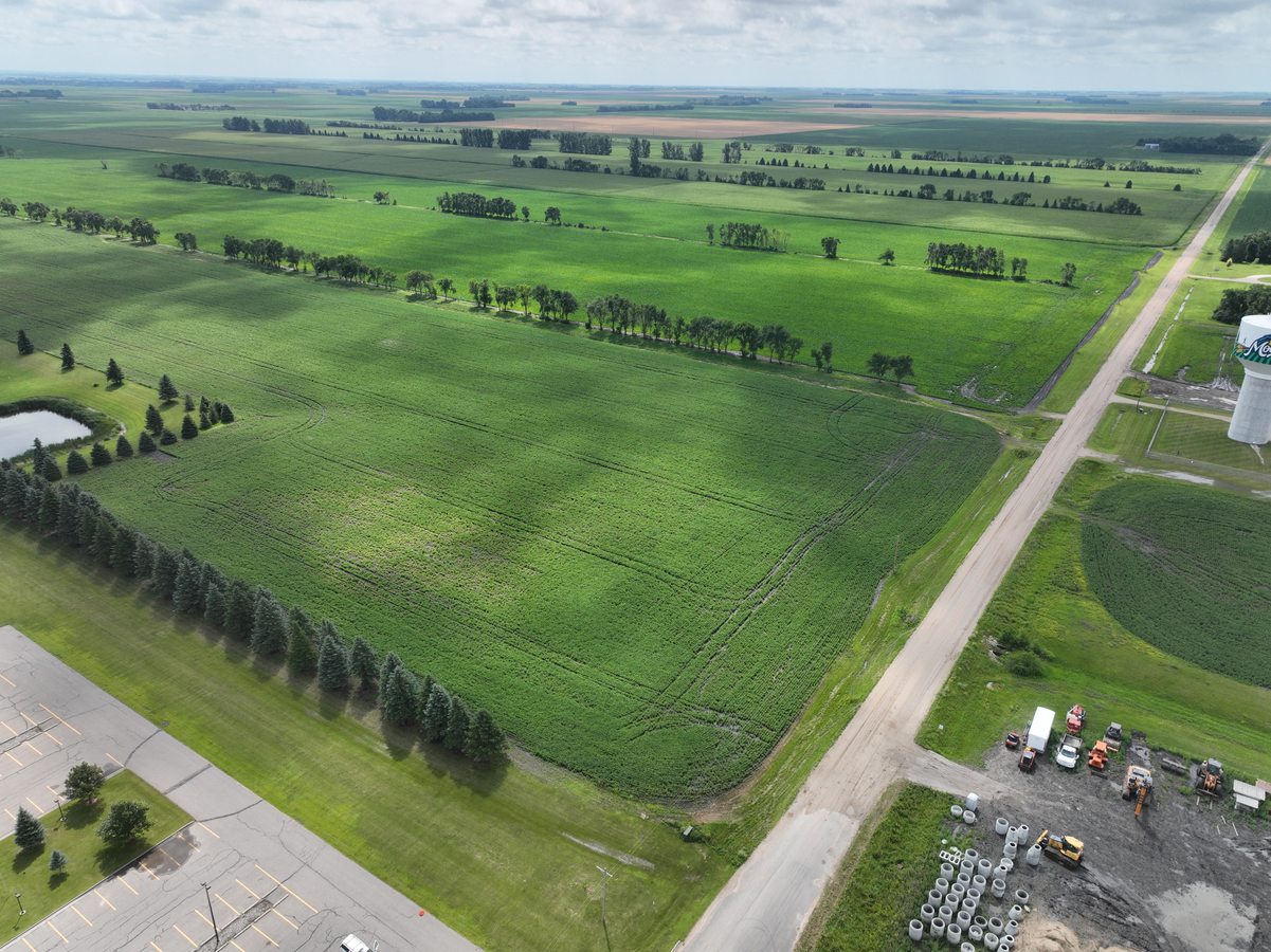
Northern Drone operates across productive Midwest farmland — the kind of large-scale grain, corn, and soybean country where aerial survey pays for itself in a single season. We cover field boundaries, drainage mapping, crop health monitoring, and precision agronomy data collection for operations of any size, from a single quarter section to thousands of acres.
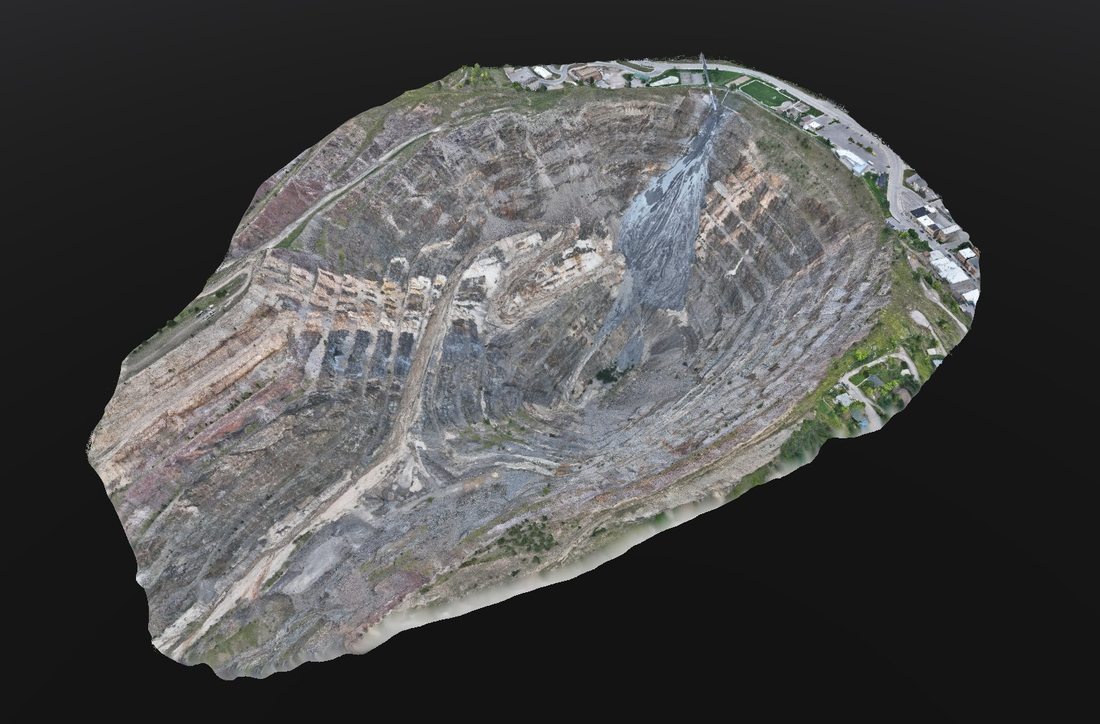
Full-site 3D textured mesh of an active quarry operation showing bench levels, haul roads, face geometry, and surrounding infrastructure. Generated from overlapping aerial imagery using photogrammetric processing — delivering a georeferenced 3D model that gives engineers, planners, and operators a complete spatial understanding of the site without boots on hazardous ground.

Textured 3D mesh of a rural site showing terrain, structures, tree lines, and drainage features in complete spatial detail. Used for land surveys, site assessments, drainage modelling, and as a georeferenced base layer for planning and design — giving landowners, surveyors, and planners an accurate, navigable 3D view of the full property without extensive ground work.
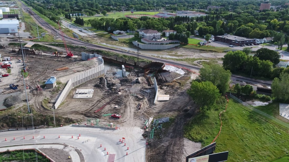
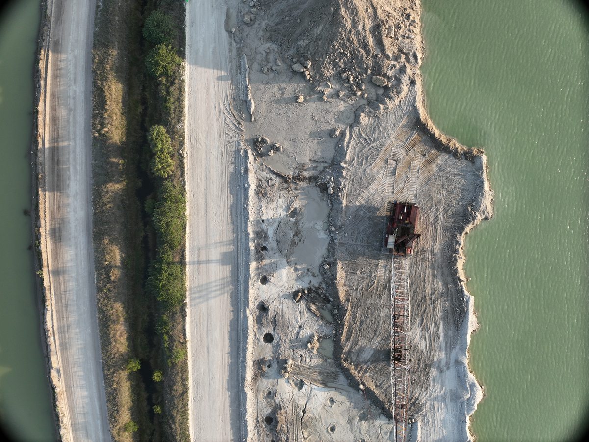
Aerial progress monitoring of an active bridge and roadway construction project — cranes, piling, retaining walls, and earthwork all captured in a single flight. Regular aerial surveys like this give project managers, engineers, and owners a timestamped visual record of site progress, helping catch deviations before they become costly rework.
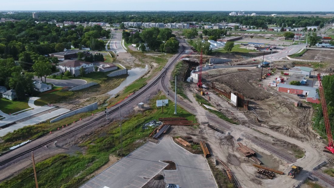
Wide-area aerial of an active infrastructure corridor showing rail, roadway, and civil construction works across an entire project zone. This full-site view is used for site management, logistics planning, and stakeholder reporting — giving the full picture of a complex, multi-trade project that no ground-level photo can capture.
More case studies coming soon.
Have a project you'd like to discuss? We're happy to walk through similar work we've done in your industry.