Why Depth Maps Get Ordered
Almost every question about a water body eventually becomes a depth question. How much capacity does the stormwater pond actually have left? What volume is the treatment dose based on? How deep is the lagoon cell, really, after fifteen years of accumulation? Where are the holes and the shallows in the lake the association manages? What did the as-built basin actually get built to?
Most of these questions go unanswered for years because the traditional answer — a boat, a crew, a day on the water — is disproportionate to the size of the pond. Drone bathymetry removes that barrier: the sonar flies, the water stays undisturbed, and a pond that would never justify a boat survey gets a real depth map in an afternoon.
How It Works
- Drone-mounted echo sounder. A single or dual-frequency sonar is flown on a precise grid just above the water surface, logging depth continuously with RTK positioning per sounding.
- Dual frequency where it earns its place. High frequency resolves the top of soft sediment; low frequency penetrates to the firmer bottom beneath it. The difference between the two is the soft-sediment layer — often the number the whole project is about.
- GPR over fresh water where conditions favor it. Shallow, weed-choked, or turbid water that gives sonar trouble is often exactly where radar bathymetry works well. We carry both and use whichever the water calls for.
- No wake, no disturbance. Nothing touches the water. Sensitive shorelines, active operations, and stocked ponds stay exactly as they were.
Deliverables
- Depth contour map — clean bathymetric contours at the interval your project needs
- Water volume — total and stage-volume tables where the application calls for them (treatment dosing, capacity planning, drawdown analysis)
- Bottom surface model — GIS and CAD-ready TIN or grid of the bed
- Soft-sediment thickness where dual-frequency data supports it
- Survey report — method, positioning, calibration, coverage, and confidence, stated plainly
Where This Gets Used
Municipal stormwater ponds and detention basins due for capacity verification; wastewater and industrial lagoons ahead of cleaning contracts; lake associations and park districts mapping their water for management and safety; golf course irrigation ponds; aggregate pits transitioning to reclamation; and engineers who need current bathymetry as the existing-conditions layer under a design. If the question is "how deep, where, and how much water" — this is the survey that answers it.
The Honest Limits
Sonar needs enough water to work in — extremely shallow margins are profiled by GPR or extrapolated, and we mark which is which. Dense submerged vegetation can mask the bottom locally; dual frequency and flight planning mitigate it, and the report flags any area where confidence drops. Volumes are computed against the water surface elevation on survey day, which we record — for stage-dependent basins, that datum matters and we treat it accordingly.
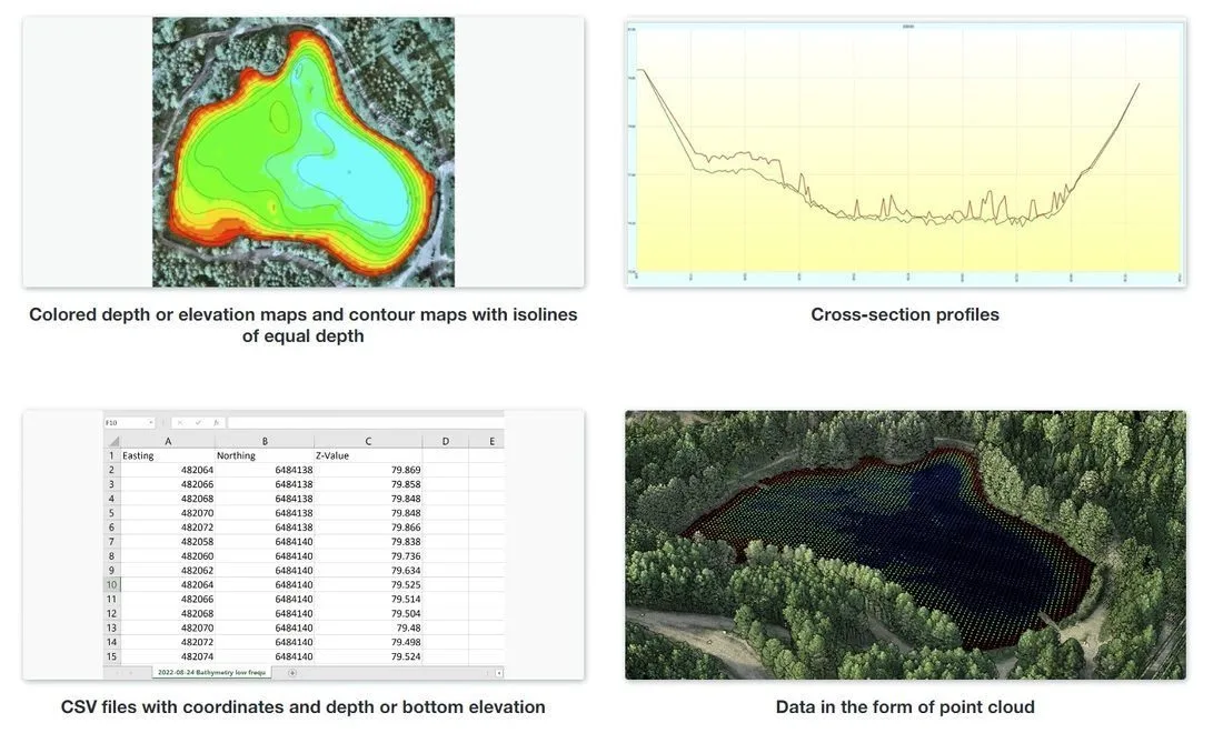
The deliverable: a depth-contoured map of the whole water body — the answer to "how deep, where, and how much water" on one sheet.
Northern Drone provides geophysical and aerial data-acquisition services. We are not a licensed land surveying or engineering firm, and "survey" on this page is used in the data-collection sense. Read the full licensure disclosure.