The Ground Nobody Can Walk
Wetlands are the worst possible place to run a ground-based survey and one of the places subsurface data matters most. Peat depth drives restoration design, carbon accounting, and construction risk. Organic soil boundaries decide where a foundation can and cannot go. Wetland projects need profiles, and the surface that needs profiling will not reliably hold a person, let alone a cart.
This is the problem airborne GPR was practically built for. The antenna flies a fixed height above the surface, the ground never takes a footprint, and the survey continues at the same pace over open water, saturated moss, and floating mat alike.
What GPR Sees in Peatland
Peat over mineral soil is close to an ideal radar target. The boundary between organic material and the mineral substrate below produces a strong, continuous reflection, and published research — including work by government geological surveys — has used GPR for peat thickness profiling for decades. Saturated peat transmits the signal well, which means the method works best precisely where the walking is worst.
- Peat thickness profiles along flight lines, tied to RTK positions — the input for volume estimates, carbon stock assessment, and restoration design.
- Basin geometry. The shape of the mineral surface beneath a bog or fen, mapped without a single probe hole.
- Organic soil extent. Where the peat thins toward the margin — the transition that matters for delineation support and foundation planning.
- Shallow water bathymetry. Open-water sections profile in the same pass; fresh water transmits radar well.
Who Orders This
Wetland restoration and mitigation projects sizing their earthwork; environmental consultants who need thickness data behind a delineation or functional assessment; agencies scoping culverts, crossings, and trail alignments over soft ground; developers and engineers who need to know how deep the unsuitable material goes before the geotechnical program prices it; and research and conservation programs quantifying peat volumes for carbon work.
How We Fly and Ground-Truth It
- Terrain-following flight at constant height above the surface, on planned lines with RTK positioning logged per trace.
- Velocity calibration against cores. Radar measures travel time; converting time to depth requires velocity, and in peat the honest way to get it is calibration probes or cores at a handful of accessible points. We say plainly that a few ground-truth points multiply the reliability of every mile of radar line.
- Documented processing. Time-zero correction, dewow, gain applied deliberately, horizons picked and exported as coordinates — the same disciplined chain as every radar product we ship.
Deliverables
- Peat thickness profiles and, where line spacing supports it, interpolated thickness surfaces and contours
- Volume estimates with the velocity basis and confidence stated
- Processed radar sections with the processing chain documented
- GIS-ready exports — CSV, DXF, shapefile-compatible geometry that drops into your wetland mapping
- Interpretation report flagging where the data is strong and where it is not
The Honest Limits
Radar depth in peat is velocity-dependent, and velocity varies with water content — which is why we calibrate rather than assume. Very conductive conditions, brackish water, or mineral-rich layers can shorten penetration. And GPR supports wetland delineation with subsurface evidence; the delineation itself is its own regulated discipline performed by qualified wetland professionals. We produce the data; where a formal determination is required, it belongs to the specialist holding that responsibility.
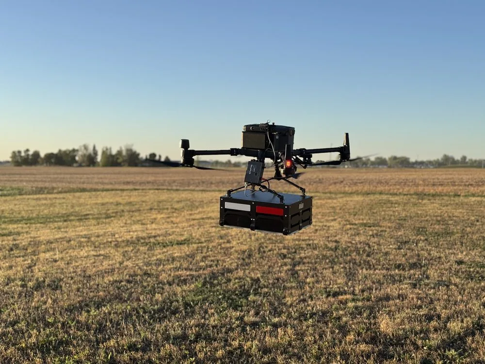
The survey ground never takes a footprint — the antenna passes over saturated ground at constant height while the data collects continuously.
Northern Drone provides geophysical and aerial data-acquisition services. We are not a licensed land surveying or engineering firm, and "survey" on this page is used in the data-collection sense. Read the full licensure disclosure.