The Gap an 811 Ticket Leaves Open
Call 811 before any excavation — always, and without exception. But understand what that ticket actually buys: member utility operators mark their own facilities, generally up to the meter or service point. Everything past that point is private, and private lines are routinely absent from the marks. On a commercial site that can mean electrical loops between buildings, gas runs to shop buildings, irrigation mains, storm laterals, septic components, old fuel or waste-oil lines, and whatever a previous owner buried and never drew.
Industry damage data tells the story plainly: a large share of utility strikes involve lines that no locate ticket was ever going to mark. The excavator assumed the paint told the whole story. It never does.
Private utility locating closes that gap. It is a deliberate survey of what is actually in the ground on your side of the meter, delivered as marks on the surface and as mapped geometry your engineer can design against.
Where This Fits in SUE
Subsurface utility engineering, standardized under ASCE 38, grades utility information by quality level: QL-D is records research, QL-C adds surface visual evidence, QL-B is geophysical designation of position, and QL-A is exposed and surveyed. Most damage happens on projects that never got past QL-D — a design drawn from decades-old as-builts that were optimistic the day they were printed.
Our work supports the QL-B tier: systematic geophysical designation of what is present and where it runs, tied to real coordinates with RTK positioning. When a project requires sealed SUE deliverables, we work under the project's licensed engineer or bring in our licensed partners — the field data is ours, the stamp is theirs, and the client gets both without hiring twice.
How We Work It
- Records first. We start from whatever exists — as-builts, permits, aerial history — because radar interpreted against records beats radar interpreted against nothing.
- GPR coverage, matched to the ground. Surface-coupled radar where the site allows it, drone-mounted radar where it does not — flooded ground, active operations, turf that must not be tracked, and large open areas where a cart grid would take days.
- RTK positioning per trace. Every radar line is coordinate-referenced, so a reflector is not "about twenty feet from the fence" — it is a mapped position.
- Marks and map together. Field marking (paint and flags) for the excavator, digital geometry for the engineer. The map survives after the paint washes off.
Deliverables
- Geo-referenced utility map — located linework exported as DXF, CSV, or GIS-ready formats
- Depth estimates with the velocity basis stated, flagged as estimates rather than dressed up as measurements
- Confidence ratings per segment — clearly located, probable, or inferred, so nobody designs against a guess without knowing it was a guess
- Marked-up site plan and photo documentation of surface marks
- Interpretation report stating method, coverage, soil response, and what the survey could not resolve
When It Works — and When It Doesn't
GPR finds boundaries between materials, which means it can detect non-metallic pipe that electromagnetic locators miss entirely — PVC, HDPE, clay tile, concrete. That is its distinctive strength. Its distinctive weakness is soil: wet, conductive clay attenuates the signal and can shrink useful depth sharply, and a small-diameter plastic line deep in heavy clay may simply not return a usable reflection. We say so when that is the case, and we recommend verification potholing on anything critical before excavation. A confident map with an honest uncertainty statement is worth more than a tidy one without.
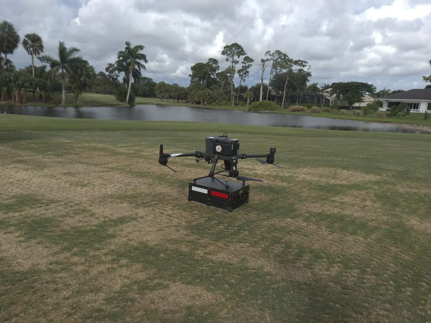
Tracing an undocumented irrigation network across a golf course — the turf is the asset, so the survey flies instead of driving a cart across the greens.
Private utility locating is a mapping and damage-prevention service. It does not replace the statutory 811 one-call locate, and Northern Drone is not a licensed engineering or land surveying firm — where sealed SUE or survey deliverables are required, we perform the field work in partnership with licensed professionals who review and stamp the final product. Read the full licensure disclosure.