Drone Survey Services in Cedar Rapids, Iowa
Cedar Rapids is about 500 miles from West Fargo, a planned deployment we usually combine with Iowa City, Waterloo or the Quad Cities. It is a city that measures its ground carefully, and for good reason: the 2008 flood put the Cedar River through downtown, the flood control system that followed is still being built out on both banks, and the 2020 derecho rewrote the tree canopy across the whole metro. Add the ag-processing plants along the river, the Iowa City and university construction market down I-380, and the limestone and sand operations that supply all of it, and there is a full deployment’s worth of LiDAR, airborne GPR, stockpile, bathymetry and corridor work.
Work We Do Around Cedar Rapids
- LiDAR mapping — floodplain, levee, floodwall and channel surfaces along the Cedar and Iowa Rivers in the project datum, pre-construction terrain and drainage models for subdivisions, industrial and campus sites, and corridor LiDAR for the lines crossing Linn, Johnson and Benton Counties.
- Drone-based GPR — limestone bedrock depth for foundation and utility design, karst and void screening where the rock is shallow, and buried utility mapping on plant, campus and redevelopment sites.
- Stockpile volumetrics — limestone, sand, gravel and recycled aggregate volumes at the quarries and contractor yards around the corridor, and grain and process-pile volumes at the plants along the river.
- Bathymetric surveys — flooded quarries, borrow pits, detention basins and river backwaters mapped without a boat, with capacity and sediment thickness for stormwater, dredging and permit work.
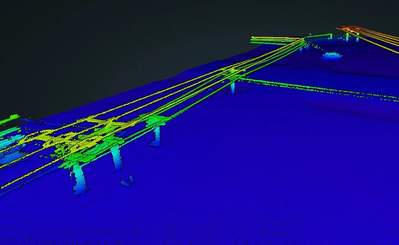
- Vegetation management LiDAR — post-derecho canopy and corridor clearance surveys for the distribution and transmission lines across the metro, with conductors and vegetation classified for clearance analysis.
- Thermal inspection — roof moisture, envelope and electrical surveys on plants, warehouses and institutional buildings, and solar and substation inspection.
Why a Planned Deployment in Cedar Rapids
Flood protection is a vertical-accuracy problem, and Cedar Rapids has more of it under construction than almost any city its size. A levee crest, a floodwall footing, a pump station pad and a removable-wall foundation all have to tie to the project datum to a few centimeters, and the terrain around them changes every construction season. We fly RTK LiDAR with independent ground checkpoints and deliver the residuals with the surface, so the engineer can verify the number rather than take it on trust, and repeat flights give a dated record of progress and pay quantities.
The Eastern Iowa Airport has Class C airspace over the southwest side of the metro, which we handle through LAANC authorization before mobilizing; most of the downtown corridor and the north side are outside it. Iowa City Municipal is non-towered. Because the drive is long, we schedule the trip with a weather window and several sites across the corridor, so a windy day costs a reshuffle rather than a second mobilization. Data is processed in West Fargo and back within 72 hours. Northern Drone is a drone data-collection firm, not a licensed land surveying firm; when a project requires certified deliverables, we partner with licensed professionals who review and stamp the final product.
Service Area Around Cedar Rapids
From Cedar Rapids we cover Marion, Hiawatha, Robins, Mount Vernon and Anamosa, Iowa City, Coralville and North Liberty down I-380, Waterloo and Cedar Falls to the northwest, Vinton and Independence, and the limestone and row-crop counties of east-central Iowa. Statewide, see our Iowa service page.
Cedar Rapids Drone Survey FAQ
Yes, as one transparent line. Cedar Rapids is about 500 miles from our base, so we fly it as a planned deployment and batch sites along the I-380 corridor and toward the Quad Cities or Waterloo. The more that goes on the trip, the smaller the travel share on each site, and the quote shows it as a single line rather than a buried day rate.
Yes. CID has Class C controlled airspace covering the southwest side of the metro. We obtain LAANC authorization for the altitude block each site needs during mission planning, so the flight is approved before we arrive. Downtown, the river corridor and the north side are mostly outside the Class C boundary.
Yes. We coordinate with the contractor and the project engineer, fly around active work without stopping it, and deliver levee, floodwall and channel surfaces in the project coordinate system so they tie directly to the design. Repeat flights give a dated record of progress and pay quantities, and bathymetry adds the channel and backwater bottom on the same datum.
Northern Drone is a drone data-collection firm, not a licensed land surveying firm. When a Cedar Rapids project requires deliverables certified by a Professional Land Surveyor or Engineer, we perform the field acquisition in partnership with licensed professionals who review and stamp the final product.
Have a Site in The Cedar Rapids–Iowa City corridor?
Tell us where it is and what you need measured. Scoped quote within one business day, with travel shown as one line, not buried in a day rate.
Get a Cedar Rapids Quote →