How Much Does a Drone LiDAR Survey Cost in North Dakota? A 2026 Guide
The honest answer to "what does a drone LiDAR survey cost in North Dakota" is a range, and the range is wide for reasons that have nothing to do with anyone hiding the ball. The price of a LiDAR survey is mostly the price of getting a crew, a sensor and a set of ground control points to your site and back, plus the processing to turn a billion points into a surface an engineer can design against. Acreage is the smallest part of it.
This guide lays out the published 2026 ranges, what changes the number on a North Dakota site specifically, and how to read a quote so you can compare two of them. We do not publish our own rate card here; every site is quoted on its own terms. But we will tell you how the math works.
The Published Ranges, So You Have a Starting Point
Across the 2026 drone-survey cost guides and marketplace data we track, LiDAR prices fall into three bands. Basic coverage of open ground, where the point cloud is the deliverable and nobody is asking for a certified surface, runs $20–$60 per acre. Typical mixed sites with ground control, a classified bare-earth surface and contours run $50–$150 per acre. Engineering-grade work under dense canopy, or small parcels where the project minimum sets the price, runs $150–$500 per acre.
Project minimums sit around $3,000. A 10-acre vegetated site is commonly quoted at $4,000–$12,000. Corridors are priced per mile rather than per acre, and published LiDAR corridor rates run $500–$2,000 per mile depending on width, vegetation and the clearance analysis that goes with it. Qualified operators charge $1,500–$3,000 per field day for collection, with processing on top.
Those are national figures. North Dakota sits inside them, but the state pushes some sites toward the bottom of the band and others toward the top, and it helps to know which way yours leans before you ask for a number.
Why "Per Acre" Is the Wrong Question
Per-acre pricing is a convenient way to compare, and a poor way to understand. On a LiDAR project the fixed costs are large and the variable costs are small. The mobilization, the ground control campaign, the airspace authorization, the sensor calibration and the processing setup cost the same whether the site is 8 acres or 80. Flight time scales with area, but flight time is the cheapest hour of the whole job.
That is why the same operator who lands at $20 per acre on a 500-acre farm will land at $200 per acre on a 5-acre lot, and why the effective rate for sites under 10 acres can exceed $150 per acre while 500-acre sites land at $10–$50. Neither number is the operator being generous or greedy. One site is paying the fixed costs once and spreading them thin; the other is paying them once and has nothing to spread them across.
The practical consequence: if you have two small sites within an hour of each other, quote them together. If you have a small site and a flexible schedule, ask whether it can ride along with another deployment. Both move the number more than negotiating the rate.
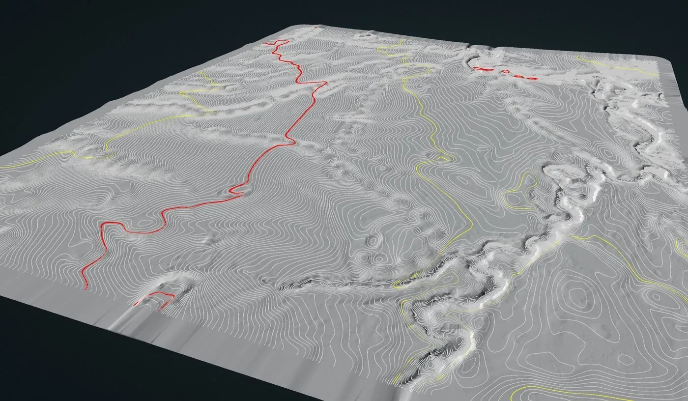
The deliverable that drives the price: a classified bare-earth surface with contours and drainage paths, in the project datum, with the residuals on the report.
What Moves the Price on a North Dakota Site
Distance from the crew. This is the biggest single variable in the state. North Dakota is big and the operators are few. A site in the Red River Valley is a same-region job for a Fargo-based crew: no mobilization line, scheduled within days. A site in the Bakken is a planned deployment from almost anywhere, with travel, lodging and a weather window built in. The survey itself costs the same; the trip does not. Always ask where the crew is coming from and whether travel is a separate, visible line on the quote. It should be.
Flat ground that still needs vertical accuracy. The Red River Valley has a few feet of relief per mile, which sounds easy and is not. Drainage design on the old bed of Glacial Lake Agassiz lives or dies on a few centimeters of elevation, so the survey has to be flown with RTK positioning and checked against independent ground control, and the checkpoint residuals have to be on the report. That is engineering-grade work and priced accordingly, even though the terrain looks simple. Operators who quote "basic coverage" rates for drainage work are quoting the wrong product.
Canopy. The Red River bottomland, the Sheyenne, the Turtle Mountains and the Pembina Gorge have real tree cover. LiDAR under canopy is the whole reason to fly LiDAR instead of photogrammetry, but it costs more: lower altitude, tighter line spacing, more flight lines, more points to classify. Open prairie and cropland are the opposite, and a harvested quarter section is about as cheap as LiDAR gets.
Airspace. Fargo, Grand Forks, Bismarck and Minot have Class D airspace; Grand Forks and Minot Air Force Bases have their own Class D plus an FAA no-fly restriction over the installations themselves. LAANC authorization is routine and should not add to your cost, but sites close to the bases need coordination that takes time and may add a mobilization if the first window falls through. Say so when you ask for a quote.
Season. Leaf-off, snow-free ground is the best LiDAR surface there is, frozen or not, which makes late October through the first lasting snowpack, and the weeks between melt and green-up, the cheapest, cleanest windows of the year. LiDAR measures the snow surface, not the ground beneath it, so a site under a foot of snow either waits or gets a different product. Wind cancels more North Dakota flights than anything else; a quote should carry a weather contingency, not a surprise re-mobilization fee.
What the deliverable has to be. A classified point cloud and a bare-earth surface is one price. Add contours, cross-sections, a corridor clearance analysis against a clearance standard, or a breakline-enforced surface for a design model and the processing hours climb. If the deliverable has to be certified by a licensed surveyor or engineer, that review and stamp is a separate professional service with its own cost, and a drone operator who is not a licensed surveyor should be telling you that plainly rather than implying the stamp is included.
A Worked Example, With National Numbers
Take a 40-acre pre-construction site on the edge of Grand Forks, half of it in cottonwoods along a coulee, the rest open. The client needs a bare-earth surface, one-foot contours and a drainage model they can hand to their civil engineer.
On the national bands, that is a mixed site with canopy and a design-grade deliverable, so it prices in the $50–$150 per acre band with the top end more likely than the bottom because of the trees and the vertical-accuracy requirement. On 40 acres that is $2,000–$6,000, and the published $3,000 project minimum lifts the bottom, so call it $3,000–$6,000 for the survey. Grand Forks is same-region for a Fargo crew, so no mobilization line. Class D airspace, handled by LAANC in advance. The deliverable set adds processing but no exotic analysis. A quote in the $4,000–$6,000 range would be unremarkable; one at $1,500 should make you ask what is missing, and one at $12,000 should make you ask what is included.
Move the same site to Watford City and the survey cost does not change, but a travel line appears. Shrink it to 5 acres and the project minimum takes over. Add a mile of transmission corridor along the property line and a per-mile corridor rate shows up next to the per-acre one.
How to Read a LiDAR Quote
Two quotes for the same site can be $3,000 apart and both be fair, because they are quoting different products. Before comparing the totals, check that both include the same things.
- Ground control and checkpoints. How many, surveyed how, and will the checkpoint residuals and achieved RMSE be reported? If the answer is vague, the accuracy claim is marketing.
- Classification. Is the ground classified by an analyst, or is the "bare earth" an automatic filter? Under canopy the difference is the whole product.
- Coordinate system and datum. The deliverable should land in your project's system, not the operator's default. Ask which one and whether a geoid model is applied.
- Deliverables, listed. Point cloud format, surface format, contour interval, any analysis, and the report. "LiDAR survey" on its own is not a deliverable list.
- Travel and weather. One transparent travel line, and a stated policy for weather days.
- Certification. If you need a stamped deliverable, who stamps it, and is that in the price?
- Turnaround. Days from flight to delivery, and what rush costs if you need it.
If a quote answers all seven without you having to ask, you are probably dealing with someone who has done this before.
When LiDAR Is Not the Answer
Spend the money when you need the ground under vegetation, when vertical accuracy decides the design, when the site is a corridor, or when the ground cannot be walked safely. Do not spend it when the site is open, flat and bare, and what you need is an orthomosaic and a surface model for planning: photogrammetry does that for a fraction of the price, and a good operator will tell you so before you ask. For stockpiles, photogrammetry is usually the better tool. For anything under water, it is bathymetry, not LiDAR. For anything under the ground, it is GPR.
The cheapest LiDAR survey is the one you did not need. The second cheapest is the one that was scoped correctly the first time.
The full national picture across every service type is on our drone survey cost guide, and the method and deliverables are on the drone LiDAR mapping page. For what we fly across the state, see drone survey services in North Dakota.
Need a LiDAR Number for a North Dakota Site?
Send us the location, the acreage, what is growing on it and what the deliverable has to support. You will get a scoped quote within one business day, with travel shown as one line, and an honest answer if photogrammetry would do the job for less.
Request a Free Quote