The Challenge
The producer needed current bathymetry on two active dredge ponds — a compliance requirement, and an operational blind spot. The traditional route meant mobilizing a boat crew onto working water, and this site would have needed real dirt work first: ramps cut just to get a boat in. Expensive, disruptive, and slow, for a survey the operation needed on a schedule.
The Approach
We flew the ponds instead. A drone-mounted sonar ran tight grid lines just above the water surface, logging RTK-positioned depth soundings continuously — no launch access, no ramps, no crew on the water, and the dredge kept working the whole time. Both ponds were fully surveyed in a single day on site.
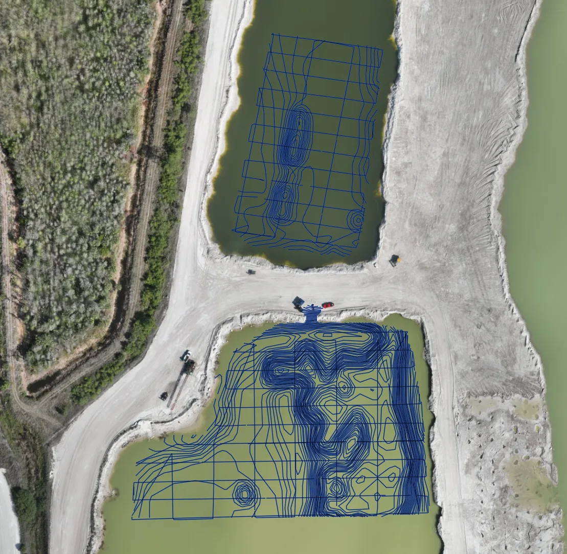
Sonar-derived depth contours over the same flight's orthomosaic — both ponds, one day, with the dredge visible mid-frame and still working.
The Result
Deliverables were in the client's hands within 48 hours: depth contours, a color-coded depth model, remaining-volume-to-remove figures, and the compliance documentation the survey existed to produce. The operation stayed compliant — that box was checked.
Then the data did something the compliance requirement never asked for. The depth model showed more material available in the center of the pit than the operation had been working to — they could dig deeper, and the survey showed exactly where. A regulatory checkbox turned into found product.
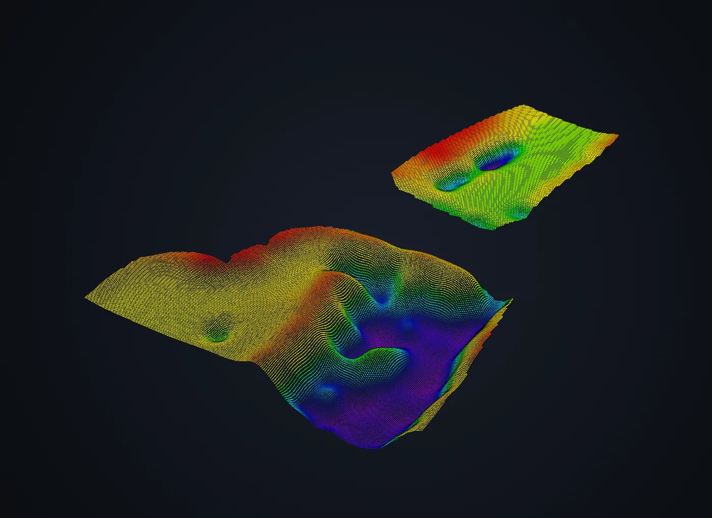
The view that changed the conversation: the pit as a true 3D surface instead of a flat contour sheet. Every point is an RTK-positioned sounding.
The reaction to the 3D surface said the rest — the client had only ever seen their pit as 2D contour sheets and spot depth markings. Seeing the actual shape of the bottom, they could read their own operation at a glance: where the deep water was, where material stood, where the dredge should work next. And the numbers held up where it counts: the dredge operator verified our depths against their own equipment as they worked.
Why It Worked
- No boat, no ramps, no shutdown — the survey happened above the operation, not in its way. The dirt work alone that a boat launch would have required cost more disruption than the entire flight.
- One day of field time, 48 hours to deliverables — compliance data on the operation's schedule, not a survey season's.
- Verified, not just measured — RTK-positioned soundings, confirmed in practice by the dredge itself.
Client identity withheld by request. Northern Drone provides geophysical and aerial data-acquisition services and is not a licensed land surveying or engineering firm. Read the full licensure disclosure.