Why Late Fall and Winter Are the Best Time to Fly LiDAR in the Upper Midwest
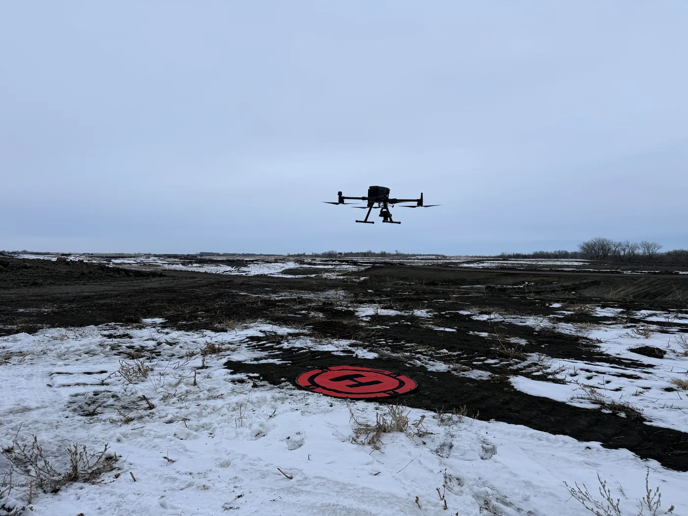
Most people assume drone survey season ends when the leaves do. For photography it mostly does. For LiDAR it is the other way around: the weeks between leaf-off and the first real snowpack, and again between melt and green-up, are the best data of the year. The canopy is open, the understory is flat, the water is as low as it gets, and once the hard freeze sets in the sloughs will hold a control point.
This is a short guide to why that is, what snow does and does not do to a LiDAR survey, and how we plan a winter flight in North Dakota, Minnesota, South Dakota and Iowa so the data is worth the cold.
What Leaf-Off Does for the Data
LiDAR gets to the ground by finding gaps in the canopy. A laser pulse that hits a leaf returns from the leaf; a pulse that threads between leaves returns from a branch, a shrub, or the ground. The sensor records several returns per pulse and ground classification works from the last returns, keeping the ones that actually reached soil and rejecting the ones that stopped on brush or a downed log. In full summer leaf, a cottonwood bottom along the Red River or a maple stand in central Minnesota lets only a small share of pulses reach the ground. In November the same stand lets most of them through.
The result is not a slightly better surface. It is a different class of surface: denser ground returns, fewer interpolated gaps, cleaner breaklines along ditches and bank tops, and a bare-earth model an engineer can trust under the trees instead of around them. Understory matters as much as canopy. Summer brush, cattails and tall grass are all above the ground the design needs; after frost they are flattened, and after a light grazing of snow they are invisible to the design and nearly invisible to the laser.
For corridor work this is the whole season. A powerline or pipeline right-of-way flown in leaf-off gives you the conductors, the structures and the true ground in one pass, which is what a clearance analysis needs. Flown in July you get the conductors and a canopy model, and the ground under it is a guess.
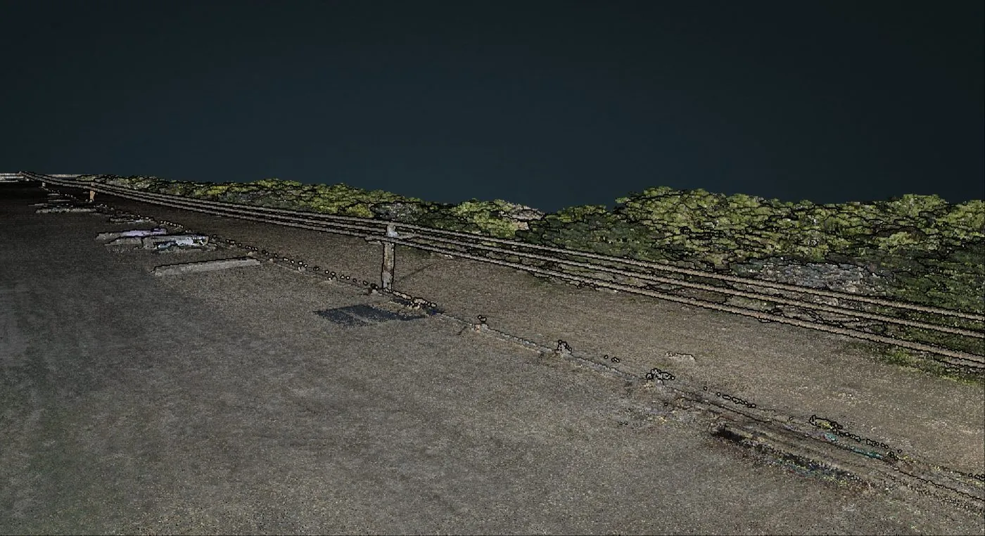
Ground returns under canopy. In leaf-off conditions the density of these returns climbs sharply, and the bare-earth surface stops being an interpolation.
What Snow Does, and Does Not, Do
Here is the part that gets oversold. LiDAR does not see through snow. The laser returns from the snow surface, exactly as it returns from a roof or a stockpile. A site under eighteen inches of drifted snow will give you a beautiful, accurate model of the snow. That is useless for design and we will not sell it as terrain.
A dusting is different. An inch or two of settled snow on frozen, flat ground adds an inch or two of elevation, roughly uniformly, and flattens the stubble and grass that would otherwise sit above the soil. That depth gets measured and documented on site, the control is set on surfaces we can tie to true ground, and the report states what the surface represents, because an inch or two of bias matters on a drainage design and nobody should discover it later. Drifts are the enemy: uneven depth around fence lines, shelterbelts, ditches and building corners puts shape into the surface that is not in the ground.
So the rule is simple. Bare frozen ground is the best surface of the year. A uniform skiff of snow is acceptable with control. Drifted or deep snow means wait for a melt window, or fly a different product. We say which it is when we scope the job, and we will move the date rather than deliver a snow model.
Frozen Ground Is Access
Half the survey problems in this region are access problems. The prairie-pothole country of the Dakotas and western Minnesota, the peat and wetland crossings in the north, the river bottoms and sloughs: in June you cannot walk a control point to the middle of them and you cannot drive a truck anywhere near them. In January you can walk, and often drive, onto ground that was impassable six months earlier.
That changes what can be surveyed at all. A drainage project that needs checkpoints across a slough gets them. A pipeline corridor through a wetland gets ground control along the whole line instead of at the road crossings. A gravel pit that is a bog in spring gets its floor and benches measured from the ice-up until the thaw. The flight was always possible; the control that makes the flight survey-grade was not.
Frozen ground also helps the other instruments. Ground-penetrating radar performs better in frozen soil than in the same soil wet, because frozen water does not attenuate the pulse the way liquid water does, so winter is a strong season for bedrock-depth and depth-of-cover work. Bathymetry is the exception: the echo sounder needs open water, so flooded pits and lakes are flown before ice-up or after ice-out, not in between.
How We Plan a Winter Flight
Daylight. December gives us about eight and a half usable hours at this latitude, and the sun stays low. Low sun does not bother the laser, but it limits any photogrammetry we fly alongside it, so we sequence the LiDAR for the shoulder hours and the imagery for midday.
Cold. The aircraft and the sensor are rated to about -20°C, just below zero Fahrenheit, and we do not fly below that. The batteries are the constraint: capacity drops in the cold and flight times shorten, so we carry more packs, keep them warm until launch, and plan tighter line blocks with more landings. It costs a little time, not accuracy.
Wind. This is the real scheduler. The northern plains blow hardest in late fall and early spring, and a 25-knot day is a no-fly day for survey-grade work regardless of temperature. We watch the forecast for a two-day window and move the trip rather than fly marginal.
Control. Ground control points go in on the day of the flight, on hard surfaces where we can (pads, culvert headwalls, frozen roads) that do not change between control survey and flight, with snow depth measured at each checkpoint so the report can state the offset between the measured surface and the ground.
Processing. Winter data classifies cleaner, and we still check it the same way: checkpoint residuals against independent points, RMSE on the report, and a visual pass for drift artifacts along fence lines and shelterbelts before anything goes out the door.
What to Fly Before the Snow
If you have been waiting for a project to "settle down" before measuring it, the next few weeks are the time. Pre-construction terrain for anything breaking ground in spring. Drainage and tile design across harvested fields. Corridor clearance on lines that were leafed over all summer. Pit floors and stockpiles before year-end inventory. Floodplain and levee surfaces before the spring melt tests them. All of these are better data in November than in July, and most of them are cheaper to fly because open ground means fewer lines.
And if the snow comes early, the second window opens in March. The ground is still frozen, the snow is going, and nothing has started to grow. It is the shortest window of the year and the one we book first.
Method and deliverables are on the drone LiDAR mapping page. For where we fly and how we schedule across the four states, see service areas.
Have a Site to Measure Before the Snow?
Tell us where it is and what the deliverable has to support. We will tell you honestly whether it should fly this month, wait for the melt window, or go now with a different product.
Request a Free Quote