Drone Bathymetric Surveys: Mapping Flooded Pits, Ponds and Waterways Without a Boat Crew
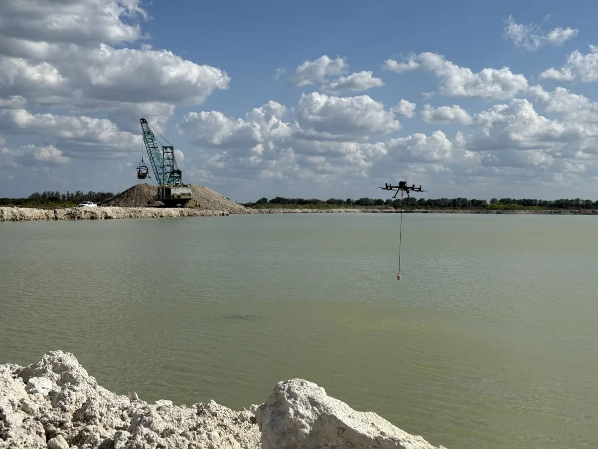
If you operate a quarry, a mine, or any site with a flooded pit, a tailings pond, or a retention basin, you already know how much you can't see. The surface tells you nothing about what's below it — the true depth, the shape of the pit walls, how much water you're actually holding, or how much sediment has quietly accumulated on the bottom over the years. And the traditional ways of finding out are slow, expensive, and often hazardous.
Bathymetric survey solves that. A drone-mounted echo sounder maps the underwater terrain of your site the same way an aerial drone maps the land above it — point by point, into a clean 3D surface model. This post covers how it works, what accuracy you can expect, and where it earns its keep.
Why Underwater Volume Is So Hard to Measure
Estimating water volume or pit geometry from the shoreline is guesswork. Operators often rely on old as-built drawings, a few manual soundings from a boat, or assumptions about the original excavation that no longer hold true after years of slumping walls and sediment buildup. The error in those estimates can be enormous — and it matters, because that number drives real decisions about dewatering, reclamation bonding, remaining reserves, and permit compliance.
The conventional alternatives all carry friction. A crewed survey boat with a sounding system means mobilizing a vessel and personnel onto the water. A dive crew means putting people underwater in cold, low-visibility, often hazardous conditions. Both are slow, both expose people to risk, and both usually require pausing nearby operations.
How Bathymetric Survey Works From a Drone
The platform — a drone carrying a compact echo sounder on a tether, flown at a constant height above the water on a pre-planned grid — emits acoustic pulses downward and times their return off the bottom. Each return becomes a depth measurement, tied to a precise GNSS position. Thousands of these soundings build a dense 3D model of the submerged surface, exactly the way photogrammetry builds a surface model from overlapping photos on land.
We deploy two sounder configurations depending on the site and the water.
Single-frequency at 450 kHz measures depth directly beneath the platform through a narrow 5° conical beam, over a 0.15–100 m range. It is the workhorse for clear-water pits and channels, producing clean profiles and volumes when run on a tight grid.
Dual-frequency runs 200 kHz and 50 kHz together. The 200 kHz return resolves depth precisely; the 50 kHz penetrates soft sediment to find the consolidated bottom beneath it. That distinction matters on a silted pond, where the difference between the mud surface and the hard bed can be the difference between an accurate remaining-capacity figure and a badly wrong one.
Both are single-beam sounders measuring along the flight line rather than swathing a wide corridor, so line spacing determines coverage — everything between adjacent lines is interpolated, and we report the spacing flown so that is visible rather than assumed.
The output is a bathymetric depth model — the underwater equivalent of a topographic surface — from which we derive water volumes, pit geometry, cross-section profiles, and sediment comparisons against any previous survey.
What Accuracy Actually Means Here
Our bathymetric surveys are run to be compatible with the IHO S-44 standard — the internationally recognized benchmark for hydrographic survey accuracy and completeness. Compatibility with an S-44 order means the survey meets defined tolerances for depth and positioning appropriate to the application.
As with any survey method, real-world accuracy depends on conditions. A few factors that matter:
- Positioning quality: Accurate results depend on a strong GNSS solution tying each sounding to a known position. RTK/PPK correction tightens this considerably.
- Water column conditions: Sonar doesn't care about water clarity the way optical methods do, but heavy suspended sediment, thermoclines (layers of differing water temperature), and entrained air can affect the acoustic return and need to be accounted for.
- Platform motion: Wind and chop introduce motion that must be compensated for; calm conditions produce the cleanest data.
- Bottom material: A hard, firm bottom returns a crisp signal. Very soft, flocculent sediment can produce a softer return that requires careful interpretation of where "the bottom" actually is.
Sonar's big advantage over any optical or diver-based method: it works regardless of how murky the water is. Visibility is irrelevant to an acoustic pulse — which is exactly why it's the right tool for cloudy quarry pits and sediment-laden ponds.
Where It Pays Off
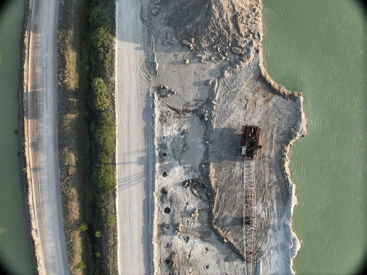
Bathymetric survey delivers the clearest value for:
- Flooded quarry pits — exact water volume and pit-wall geometry for dewatering planning and remaining-reserve decisions
- Mine voids and pit lakes — geometry and volume data critical to extraction planning and closure
- Retention, tailings and settling ponds — capacity verification and sediment accumulation tracking over time
- Reclamation and permitting — defensible volume and depth data for regulatory and bonding requirements
- Waterways, channels and shorelines — depth mapping and shoaling assessment without putting a boat crew on the water
What a Northern Drone Bathymetric Survey Delivers
Every bathymetric survey we complete includes:
- Color-coded depth map of the full surveyed area
- Bathymetric surface model (DEM) of the underwater terrain
- Cross-section profiles through the pit or pond
- Water volume calculation, plus sediment-accumulation comparison against a prior survey when available
- All data in GIS-ready formats alongside a clean PDF summary report
Standard turnaround is 72 hours from survey completion. Rush processing in 36 hours is available when you need the numbers faster — and no personnel ever enter the water.
The Bottom Line
You can't manage what you can't measure, and for any flooded pit or pond, the most important numbers are the ones hidden below the surface. Drone bathymetric survey replaces guesswork and risky boat-or-dive operations with precise, repeatable, IHO S-44–compatible data — captured fast, with nobody in the water and no operational downtime.
If you're making dewatering, reclamation, or reserve decisions based on old drawings or rough estimates, a bathymetric survey will tell you what you're actually working with.
Know Exactly What's Below the Waterline
Tell us about your pit, pond, or waterway and we'll scope a bathymetric survey that gives you real depth, volume, and sediment data.
Request a Free Quote